If you think of the original Mile Cross Estate as a triangle with the Southern point being where the Aylsham and Drayton Roads head off in separate directions towards their namesakes, the other two points of the estate triangle sit at either end of the aptly-named Boundary Road as the two roads leave the city and head off out into Norfolk.
Here the City and County of Norwich becomes (or became) the County of Norfolk.
County of Norwich? Yep, Norwich was still technically a County, even as recently as 1974. Back in 1404 the City of Norwich was made into a separate County (or a County Corporate) and it became independent from its host County of Norfolk. Like a lot of the rapidly-growing towns and Cities, Norwich was deemed important enough to become independent from its county, which (amongst other things) gave it a few extra privileges with regards to self-government that a City wouldn’t normally receive. Norwich was rapidly becoming England’s 2nd most important City only being out-ranked by London. An interesting point to add here is that the City of Norwich – inside the walls – was actually larger than the City of London. Continue reading “Crosses for miles”
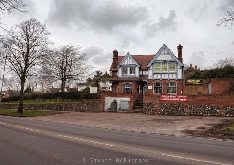
 In the northern corner of the estate and just behind the Boundary Pub is a quiet little cul-de-sac named Spynke Road. Like a lot of the roads up there it didn’t start off this way and used to share a junction with Boundary road. It has since been closed off to stop people rat-running through the estate and to reduce accidents along the now insanely busy Boundary Road. Because of these road closures the area now has a strangely quiet and closed-off feel but with the unrelenting background drone of of traffic.