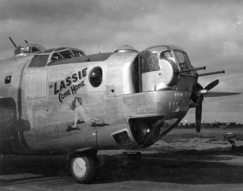
 In the northern corner of the estate and just behind the Boundary Pub is a quiet little cul-de-sac named Spynke Road. Like a lot of the roads up there it didn’t start off this way and used to share a junction with Boundary road. It has since been closed off to stop people rat-running through the estate and to reduce accidents along the now insanely busy Boundary Road. Because of these road closures the area now has a strangely quiet and closed-off feel but with the unrelenting background drone of of traffic. Continue reading “Lassie Come Home”
Tag people
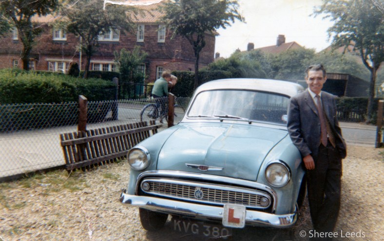
Mr Leeds unwittingly adds some detail…
Going on from my last blog entry ‘Green to mud or bricks’, a certain ‘Fred Leeds’ appeared to me in the vision of this battered old photograph, taken in the mid-1960’s to validate some of my previous points, and to highlight that not all of those little spaces have been filled in as of yet.
Nigel Neale
I must admit that I’ve talked quite a lot about Drayton Road in this blog, mainly because it has a lot of stories to tell and partly because I’ve lived on (or just off) it for all bar seven years of my life. This is the main artery for traffic in and out of the City from the North-West and effectively chops about a third of the estate off along the southern portion. Located in the Island part of the estate from the estate’s creation and up until about ten years ago sat the majority of the estate’s schools (Dowson First and Mile Cross Middle), so getting the kids across Drayton road safely required a lot of work from the two sets of dedicated Lollipop ladies.
The first set operated at the crossroads of the Drayton, Bignold and Parr Roads and the second set a few hundred meters down the road at the (long-since closed) junction of Drayton and Wheeler Road. In the early to mid 1980’s, both sets of ladies witnessed their fair share of drama and tragedy.
Two incidents stand out amongst the madness that was – and still is – getting across Drayton Road as a child and I’ll start with the later incident first:
In the mid-1980’s a driver claiming to be unsighted by the low morning sun as he came up Drayton Road from North West ploughed straight through a crowd of Mile Cross Middle and Dowson School children being shepherded across the road by the crossing lady. How nobody was killed is beyond me; one boy ended up near the bus stop, the boy walking just in front of me was thrown 20 feet into the air…. blood, chunks of hair, scattered books and Panini stickers littered the scene.
The result was this pelican crossing, installed slightly east of the junction:  Continue reading “Nigel Neale”
A window into the past
Then and now. Mary Jacobs.

Mary Jacobs poses proudly for a photograph Continue reading “A window into the past”
Schooled at the old skool school
Over the years there have been six schools in one form or another on the Mile Cross estate.
Dowson Infant School opened on the 6th December, 1926 and received it’s first 66 students from a small and temporary, School off Brazier Road. Then on 27th January 1928 the Dowson Primary School opened next door
, bringing in a further 193 pupils, aged 7.5 to 10.5 years. This number grew to 442 pupils by July 1934, which is quite a lot when you consider that the by today’s standards the two connected schools were fairly small.
I only have this one image of the school in my photographic arsenal and it is of one of the two School halls. It’s taken after closure, but the school can still be found on some of the older versions of Google maps. This shot is of the Mile Cross Middle School Hall. In here I used to do country-dancing (against my will), play rounders, partake in gym (in your pants if you’d forgotten your kit), rearrange the words to various hymns during assembly (can you believe we were forced to sing hymns?) and later on wear out the knees of my flecked-trousers skidding along the floor to the ‘Final Countdown’ by ‘Europe’ during many a 1980’s school disco. I always used to think it was a replica of Noah’s Ark when sat cross-legged on the hard floor listening to the Head Master, Mr Keene bang on about something or other. Looking at it now, it did look a bit boat-like. Continue reading “Schooled at the old skool school”
FONCS: Friends of Norwich City Station
Straying away from the estate for a bit, I’m going to be talking about how the digital world can bring people together in the real world.
Since being knee-high to a grass hopper I’ve been fascinated by a stretch of path that runs along the back of Sloughbottom Park. It starts at the inner-link road by Halfords and makes its way along the Wensum Valley all the way to Themelthorpe, before curving East towards Reepham. You’ve probably heard of it as it’s called: ‘The Marriott’s Way’; but before it got ‘all official’ it was just an overgrown and dusty old path where a railway used to run. Back then it was mostly impassable in Summer and littered with the wrecks of stolen and burnt out cars and bikes.
I first encountered the path as a child. My Auntie used to live in Costessey in a house somewhere near Leewood Crescent (I can’t remember exactly where) and later, my Nan lived in a Bungalow at the bottom of Oval Road. Back in those days my family did a lot of walking, and the most direct route to go and visit these nearby family members would have been through Sloughbottom Park and down the old railway line. The path wasn’t metaled back then as it wasn’t officially a path, so it was often full of nettles or damp and muddy. Or both. I remember in the height of Summer having to fight our way through the nettles with a stick. Even so it was quicker to go this way rather than follow the roads. I’d be back and forth along here on a regular basis and the path became well and truly etched into my memories.
One day my mum stopped at a stretch of brick wall that I’d never noticed before – even though I must have walked past it countless times (It must have been exposed from the weeds because of winter die-back) – to give me an impromptu history lesson. She told me that it used to be the site of an old railway station called Hellesdon that had been closed back in the 1960’s. She had vague recollections of it even though it had shut to passengers back in 1952. The station still served Norfolk County Council as a storage spot for road aggregates. The station building being used for other things, such as a Sunday School and later as the headquarters for a company named: ‘Anglian Culinary Services’.
The building eventually fell into disrepair and was used as a drinking hotspot for youths from the nearby Marlpit Housing Estate. To resolve this problem the council decided to knock the building down. Unfortunately this turned out to be a rather a short-sighted solution. Along with the Station house about a third of the platform was also destroyed, and then weirdly finished off neatly with some later, red brick.  Continue reading “FONCS: Friends of Norwich City Station”
Running from Ghosts
Just a short entry to keep things bubbling along whilst I work on a ‘War and Peace’ sized item about Mile Cross pubs…
Anybody who went to the Dowson Junior or Mile Cross Middle schools will probably remember the fabled cross-country course. It was situated behind Sloughbottom Park and on what is now the Marriott’s Way. We’d run from the School field on the opposite side of Bowers Avenue (more on the schools later), through the corner of Sloughbottom Park, up and down through a storm drain, along an abandoned railway and through a bit of woodland recently killed off by May and Baker’s pollution. There’s a reason why Mile Cross kids had a reputation for being hard little so and so’s…
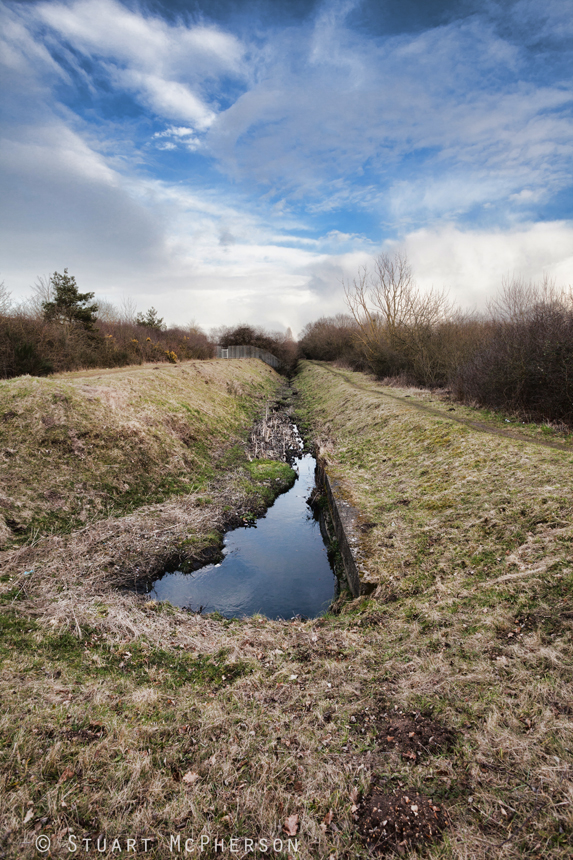
The first obstacle we’d encounter was known as the ‘Big Dipper’, which basically meant running through a gap in the fence and into (and back out of) the storm drain. This storm drain appears from the ground near Sweetbriar Indutrial estate and runs along, behind the park, behind the Council Recycling Centre (The tip) and Anderson’s Meadow before depositing all its oily surface run-off water into the Wensum, just behind the new Aldi (former Wickes site). It was full of oil, water, rubbish and god-knows-what, and it was advisable to jump over, rather than run through it. The second obstacle we’d encounter would be to run down another steep hill and onto the former M&GN trackbed. This wasn’t the neatly-trimmed path we know now, but the remains of a railway that had only recently had the sleepers removed. It was overgrown, full of nettles and was often littered with the burnt-out wrecks of stolen cars (the 1980’s was blighted by ‘joyriding’). We’d travel West along the old track-bed before taking a right at the Sweetbriar Road bridge and into the next obstacle: A dead, hilly bit of woodland, full of dead Silver Birch trees – reeking of chemicals – which then lead us back into Sloughbottom Park through another hole in the fence.
A couple of stories stick in my mind from the Cross Country run:
My schoolmate at the time: Billie (William) took a tumble down the big-dipper and broke his hip. For reasons unknown to me, his mother quickly appeared on the scene with a rickety, old push-chair which was used as a makeshift stretcher to wheel him back across Sloughbottom Park and off to the hospital; the agonised moans coming from his mouth as he was bounced across the grass in that pushchair (that was far too small for him) still stick in my mind and to this day and I often wonder where he is now.
The ‘Big Dipper’:
There be Pirates!
Tucked away in a quiet little corner of Sloughbottom park is a faint little oval in the grass. When the sun shines and the rain falls, it can be easily overlooked in between the irregular Council grass trims. I remember it looking a lot fresher as a kid in the 80’s, the 80 yard Harco-surfaced track was fresh and it was still occasionally being used.
I remember the park-keeper at the time, a friendly old boy named Phil (Pilbrow?) who my friends and I would often chat to, and he would occasionally bore us with tales of how back in the day he was a bit of a demon on the cycle speedway. If only I knew then (a scruffy-looking little scamp on BMX) that in the future I’d be sitting at a PC blogging about him, I’d have probably paid a bit more interest in what he was trying tell us. When he’d finally get bored of our glazed-over and disinterested faces he’d disappear back into the Pavilion to get back on with his work. This would be the cue for this cheeky little collection of scamps to pick up his funny little green 3-wheeled Council van (remember those?) and relocate it somewhere impossible for him to drive it out of, before cycling away as fast as we could. In hindsight, had he wanted to chase us down we’d chosen the wrong man to tempt fate with on a bicycle!

Over the Wensum and down with a bump.
Mile Cross sits to the North West of the City Centre and on the far bank of the river Wensum, so for access to the soon-to-be-built estate and subsequent expansion of the City further to the North and West, the Corporation needed to start building bridges.
Before any of the new bridges existed, the only means of crossing the Wensum – other than paying the ferryman at Dolphin – would have been at the old bridge in Hellesdon (Hellesdon Road) or at the newer (1882) bridge situated at Norwich City Station (now Halfords on the inner ring road). These two bridges are over a mile apart so it would have been a bit of a trek in either direction to get across. It seemed more important to get the Loco’s and their trains over the river than anything else, but people being people, always tend to find the quickest route of getting from A to B and I wonder how many people would have risked a dash across the narrow, single tracked A-Frame railway bridge to avoid paying the ferryman.
The first of the newer bridges to spring up was the Dolphin Footbridge.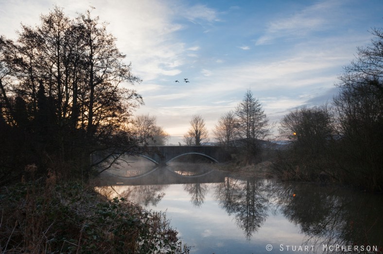 Continue reading “Over the Wensum and down with a bump.”
Sandys-Winsch goes gardening
Mile Cross Gardens.
 At the entrance to the estate at Suckling Avenue sit two ornamental gardens. These once-attractive gardens were designed by the parks superintendent Captain Sandys-Winch Continue reading “Sandys-Winsch goes gardening”
