The History of Sweet Briar Marsh

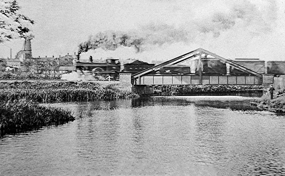
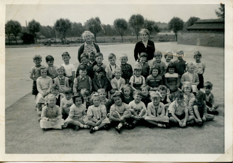
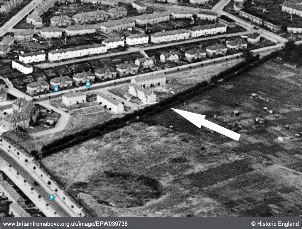
Sweet Briar marshes are both close to my home and close to my heart, situated less than five hundred meters away from my back garden and a place I loved exploring as a child. They’re a place where you can escape to and forget that you live within an ever-expanding city, seemingly intent on gobbling up all the lovely green bits that surround it. It’s also often fondly remembered by some of the veteran Mile Cross residents who would sneak across the railway lines, avoiding the railway police and the farmers to indulge in some dyke-jumping or to collect tadpoles. At thirty-six hectares the marshes are relic of the wet meadows that straddled the rare chalk stream named the river Wensum (which is the Anglo Saxon word for winding) all the way from its source out at Whissonsett in a remote part of the UK’s driest and flattest county, to it’s confluence with the river Yare just east of the city. There are only 210 of these rare chalk streams in the world, of which 160 (73%) are to be found here in the UK, many of which can be found right here in Norfolk. The largest being our very own river Wensum, which also happens to be one of the finest examples in the country. The Wensum glides by the southern edges of our estate from Hellesdon, entering under the fairly recently added Sweetbriar Bridge of 1933, before opening out nicely as the Sweetbriar and Mile Cross marshes right on our doorstep. From there it meanders at a leisurely pace right into the centre of our city, creating a little slither of green, an unusual little oasis of nature right up until the point it drops into the city (literally) over the sluices at New Mills Yard. From here on in the river is once again tidal as it merges into and rather confusingly gets consumed by it’s smaller sibling, the River Yare, which then transports the ghost of the Wensum all the way out to sea at the Yare’s mouth or Great Yarmouth. Wouldn’t ‘Great Wensumouth’ sound much better? From here it makes its way back into the atmosphere only to be dumped on the land once again upstream to start the whole cycle all over again.

Evening sun on Sweetbriar marsh
Continue reading “The History of Sweet Briar Marsh”

The Tale of the Wensum Dipper

I have told the tale of the Wensum Dipper in the past, but that piece was written a while back now, and since then some new details and images have come to light in a massive collection of images and information about the history of Norwich, kindly given to me by another Mile Cross Resident, which has helped to shed some more light on this peculiar episode. For those of you who didn’t read the original piece, written way back in 2018 (have I really been running on for that long now? Mad), the story was fairly straight forward: A mix up with a set of points at the exit of the railway yard at City Station meant that a locomotive pulling a long train ended up in the murky waters of the Wensum. I managed to fill in some of the gaps with some living recollections, a bit of local knowledge, including some fine research by my good friend and fellow Mile Cross lad (and one of our Norfolk Railway Heritage Group experts) John Batley, and a little bit of educated guesswork. Now knowing more detail, it seems that we had got some of the finer details spot-on with some of our educated guesses, which is always comforting to know.

The scene of the accident, captured in this wonderful, early image of the distinctive A-Frame bridge.
Continue reading “The Tale of the Wensum Dipper”

The Bells of St Mary, Coslany ring out across Mile Cross

Not long after Mile Cross had completed it’s first and second waves of house-building and providing this new housing estate with over 8,000 people, it was decided (by the Bishop of Norwich) that all of these new residents needed a bit more god in their lives. God would be shoe-horned into the new estate via the medium of a shiny, new church situated right on our doorsteps. The building of a new church is by no means a cheap venture so it was decided (once again by the bishop of Norwich) that a fundraising appeal for this new church would be sent out with haste.

Continue reading “The Bells of St Mary, Coslany ring out across Mile Cross”

Glenmore Gardens and the Coronation of Elizabeth II

A few months ago I was contacted by a chap named Robin Clare who told me that he had in his possession a booklet and a collection of photographs that may be of interest to a man like myself. The photographs were taken during a street party laid on by the residents of Glenmore Gardens to celebrate the Coronation of Queen Elizabeth II in 1953. The event, which took place a week before the actual event, looks as though it was a very well organised affair and required two separate committees to help organise and run it. These committees were made up by residents of the gardens and their roles were to appeal for help and funding for their planned celebrations. Thankfully for them the response to their appeals were very successful, with local businesses, tradespeople and local residents being very generous with their offerings.

The children of Glenmore Gardens enjoying a meal as the parents and locals watch on.
Continue reading “Glenmore Gardens and the Coronation of Elizabeth II”

Mile Cross Pioneers and The ‘Wooden Slums’

During the research phase of the recent Mile Cross 100 project one of the little details we were hoping to find out was who were the first people to move into a Mile Cross home on the new estate, however, I wasn’t surprised to learn that we couldn’t figure out exactly who those very first tenants were. I mean, we had some names of people who were here in the beginning, but it was nigh-on impossible to pin down any one person or family that were given the very first set of keys here in Mile Cross, which was a bit of a shame. We knew that people started moving in to some of the first purpose-built Council-owned homes in around 1923, at around the same time, or not long after the new bridge at Mile Cross was opened in September of the same year. By using the Kelly’s Directories (Heritage Centre, top floor, Forum) of the time I did manage to build a fairly accurate map of which streets were inhabited, and in which years. For example, at the start of 1924 there were people already living at Bolingbroke Road, Chambers Road, Civic Gardens, Losinga Crescent, Marshall Road and Rye Avenue, but not all of those roads were yet fully inhabited, or indeed completed at this point. People were effectively moving into a building site, and this theme continued on for about seven years.

Continue reading “Mile Cross Pioneers and The ‘Wooden Slums’”

Curiosity leads to unexpected stories from my little corner of the Drayton Estate.

A quiet corner of the Drayton Estate as seen from the once-empty 3 Pinder Close

A while back I wrote a piece about a house just around the corner from mine that had stood empty for a few years (click to read). This house had barely been modernised over the years, and the more I delved into the history of this one particular house, the more interesting it became. Often is the case when researching your local history, following your nose often leads you down historical alleyways that you never expected to end up in, and more often than not, they end up being more fascinating than you ever could have imagined. And it’s this kind of follow-your-nose research that the MX100 research leads, myself included, had been teaching our fellow citizen researchers as we encouraged them to dig for interesting snippets of the estate’s history for the recent Mile Cross 100 project. Another part of this process was also asking for the public to provide us with their own stories about Mile Cross.

Continue reading “Curiosity leads to unexpected stories from my little corner of the Drayton Estate.”

Mile Cross Photo Walks

Just a short (but picture-heavy) piece this time, and it’s about a project I’ve been involved with for the best part of a year; the Pit Stop Mile Cross Photo walks, in conjunction with a Norfolk-based charity focusing exclusively on the health and wellbeing of men, named MensCraft. Men were invited to join me as ‘The Mile Cross Man’ (or just plain-old Stu) on bi-weekly photo walks within the Mile Cross Estate, starting at Civic Gardens. No photographic experience or fancy photographic equipment were necessary, and my tagline was: “We’ll go for a wander about the estate with our cameras to find some interesting new angles. I might even bore you with some history along the way”.

The rarely-photographed Mile Cross Man with camera in hand on a bright (but chilly) Sunday morning. By Colin Howey.
Continue reading “Mile Cross Photo Walks”

Cheaper than a revolution

So, it’s been 100 years since those first residents began moving into their new Mile Cross Homes and here in 2023’s take on Mile Cross, we’ve been celebrating the estate’s centenary in many ways. First up was the free theatre/show by the wonderfully on-point theatre company, The Common Lot; named “The Great Estate, 100 Years of Mile Cross”, then there’s the website, (that we still need your help with), The Humap 100 years of Mile Cross (take me there!). There’s also an up-and-coming publication that I’ll be involved with, all about 100 years of Mile Cross called “The Mile Cross Miscellany”, along with the reawakening of the Mile Cross Festival, and a Mile Cross House Lantern Parade, coming in September.

Continue reading “Cheaper than a revolution”

Mile Cross Photographic Walks and Mile Cross Story Finders.

This is just a short entry to let you all know that I am still here. I realise that it’s been quite a while since I’ve written anything (for this website at least) but that doesn’t mean I’m no longer involved or engaged. Over the last few months I’ve been spread quite thin with various Mile Cross related projects; I’ve written a piece about the trees here in Mile Cross for the Norfolk Gardens Trust Magazine (downloadable here soon), I’ve been writing pieces for the new Mile Cross Newsletter, “mileXchange”, which hopefully you read after it dropped through your letterbox recently (if you live in Mile Cross, that is), the second issue should follow shortly. I’ve also been helping to come up with ideas on how to use the soon-to-open community space named the “mileXchange” in the former Draytona Bakery shop on Drayton Road. On top of all that, I’ve also spent a considerable amount of my spare time as one of the lead researchers for the “Mile Cross 100” project which in 2023 will celebrate the Mile Cross estate turning one hundred years of age.

MX100 logo.

We aim to celebrate a Centenary of Mile Cross by creating a play, a pageant, a website and a book about Mile Cross, so there will be lots to look forward to in the next few months, some of which we’re hoping residents or former residents of Mile Cross can get involved with.

Continue reading “Mile Cross Photographic Walks and Mile Cross Story Finders.”

PC Allcock takes a beating

For a couple of my previous pieces ( Old Farm Lane and Sweetbriar Marsh ) I’d been studiously looking into the countryside landscape and the scattering of buildings that were here in what we now call Mile Cross, long before the later housing estate turned up. Whilst poring over the old maps and aerial photographs, searching the landscape for anything of interest, my eyes kept falling upon a little lane that was lost long ago. This little lane was called “Half Mile Lane” and it ran south from Upper Hellesdon Road (now Aylsham Road) down to Lower Hellesdon Road (now Drayton Road), seeming only exist to enable the local farmers to access the many fields that made up our landscape and to connect the two main roads together. Unlike the bloated and expanding city we live in today, Norwich had barely stretched out this far along Lower Hellesdon Road, the only buildings of any merit being the ancient Lower Hellesdon Farm and the pair of old Red Cottages about half a mile further out at the slough bottom. However, at the northern end of Half Mile Lane where it met Upper Hellesdon (Aylsham) Road, The city had been a little more adventurous, managing to branch its way out along the busy, Aylsham/Cromer Road as far as the boundary. Along this busier trunk road, which led out to Aylsham and the then the coast, the maps show that there were plenty of homes and businesses dotted along it all the way from the inner boundary at the old city walls, right the way up to the outer boundary of the city and county at the imaginatively named boundary at St Faith’s Cross, or the area known then as Mile Cross.

The lower half of Half Mile Lane running from Mile Cross Road (top right) to Drayton Road (bottom left), now lost under the gardens of the later added homes of Shorncliffe Avenue. In this image the fields have been replaced by houses to the west and allotments to the east, and the northern half of the lane has been repurposed as Mile Cross Road.

Why this particular little country lane with no buildings along it had intrigued me so much is anyone’s guess, but when I started searching for any references to it I wasn’t really expecting to find anything. To my delight I kept finding the road mentioned in newspaper articles from the early 1900’s, which only helped to feed my curiosities further. The lane was not completely forgotten by the passing of time either and two later-added roads, part of the “Mill Hill” extension to Mile Cross estate; Half Mile Road and Half Mile Close were named after it, even though they don’t mirror it. On top of this, although the old Half Mile Lane no longer exists in name, many of us have regularly and unwittingly travelled the northernmost half of it as we walk or drive along the later-added Mile Cross Road.

Continue reading “PC Allcock takes a beating”