What’s in a road name?

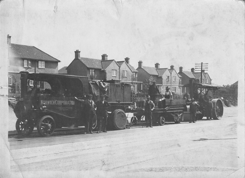
The Mile Cross Estate has some very interesting road names from a historical point of view so I thought I’d take a closer look at the history behind those battered old nameplates to try to ascertain what all those names mean and why. As it turns out most of the road names read to be a veritable “who’s who” of famous Norwich Citizens, albeit from an early 20th Century viewpoint and with a few Paston Family related place-names thrown in to the mix. I decided to take a look at most of the road names in what I call the ‘original’ part of Mile Cross as a Corporation-built Estate along with a few just outside of those now imaginary boundaries. The following list is what I have managed to come up with. Some of them were fairly obvious and easy to research but some were a little harder to figure out. I’ve tried my best to be as accurate as possible when it came to the naming conventions being applied in the early 1920’s but even if I haven’t necessarily found the correct person for the name-plate, the historical points made below are still legitimate and hopefully make for some interesting little glimpses into the past of our fine City:

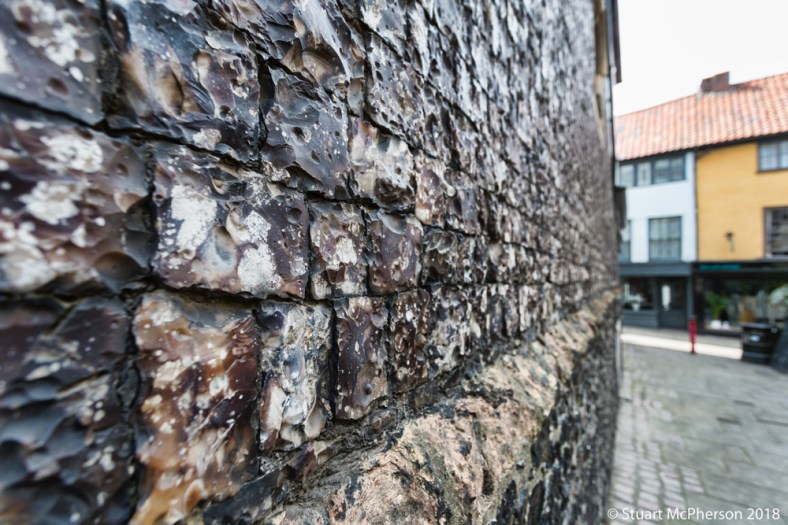
Appleyard Crescent – William Appleyard was 3 times sheriff and 5 times City Mayor. William was the first Mayor of the City after it became a shire incorporate in 1404. He owned a lot of property in the City and Inherited from his father the house that now incorporates the Bridewell Museum, famed for it’s finely-cut black flint bricks. William presented the City with a great tree to aid with building the new Guildhall. He also owned a lot of land to the South of the City, including Intwood, Bracon Ash and Hethel.
His father was given the rather odd responsibility of providing the King with 224 Herring Pasties whenever he visited the region.

RN4

Continue reading “What’s in a road name?”

Mile Cross Depot

In 1958 Norwich City Council decided it would be a good idea to move their entire labour force to a brand new and centralised depot named The “Norwich City Works Department”. The new depot was to be located Just off Mile Cross Road, opposite Harmers Clothing Factory and the junction of Havers Road and it was to be built on 6.5 acres of former allotments and farmland situated in the fairly wide depression here at the bottom of the Wensum Valley.

The new depot officially opened its gates to its workforce in 1965, although most of the workers would have already being there for some time already, considering it was their job to construct their new premises. The marshy ground of the valley floor had been being steadily firmed-up since the Second World War when the area had was increasingly being used as a dumping ground for landfill and hard-core, most of being transferred here from the destroyed buildings of the nearby bomb sites around the St Benedict’s and Dereham Road area.

You can see it slowly taking over the allotment space as it’s being flattened out by a Corporation Steam Roller in this 1948 Britain From Above image of the area:

MXBFA Continue reading “Mile Cross Depot”

Crosses for miles

If you think of the original Mile Cross Estate as a triangle with the Southern point being where the Aylsham and Drayton Roads head off in separate directions towards their namesakes, the other two points of the estate triangle sit at either end of the aptly-named Boundary Road as the two roads leave the city and head off out into Norfolk.
Here the City and County of Norwich becomes (or became) the County of Norfolk.
County of Norwich? Yep, Norwich was still technically a County, even as recently as 1974. Back in 1404 the City of Norwich was made into a separate County (or a County Corporate) and it became independent from its host County of Norfolk. Like a lot of the rapidly-growing towns and Cities, Norwich was deemed important enough to become independent from its county, which (amongst other things) gave it a few extra privileges with regards to self-government that a City wouldn’t normally receive. Norwich was rapidly becoming England’s 2nd most important City only being out-ranked by London. An interesting point to add here is that the City of Norwich – inside the walls – was actually larger than the City of London. Continue reading “Crosses for miles”

Bloody vandals

Just a short entry tonight after I spotted something of interest as I was dropping off some donations to the Hallswood Animal sanctuary Charity Shop on Drayton Road. On the wall opposite the entrance and next to one of the residential doors is a concentration of ‘graffiti’. On closer inspection some of the inscriptions are quite old. Admittedly they’re not going to get any of the medieval graffiti experts too excited but the shops were only built in 1929.
MXVandAfter a quick zoom in on Photoshop this small section of wall revealed quite a few initials and dates: Continue reading “Bloody vandals”

Dick’s Story: Lassie Come Home.

You may have read the last blog entry about a tragic accident that happened on the estate towards the end of the Second World War. A Consolidated B-24 Liberator of the USAAF crashed on its final approach to the Horsham St Faith Airbase killing 8 of its 9 crew, two young children and changing the lives of their friends and family forever. If you haven’t read it already, I recommend that you do so first before reading this entry and that blog entry can be found by clicking this link.

After sharing the story on Social Media I was rather taken aback by the positive response it received and it has probably been the most-read (and commented) post of this blog so far.

One of the many people who commented on Social Media was a ‘Dick Kemp’. Dick (Richard) Kemp was the young lad whose garden the plane came down onto and it was his sister and cousin who were killed along with the American Airmen. Shortly after commenting on the post Dick sent me an email asking if I’d forward him the story so that he could share it with his extended family. Of course I obliged and emailed it over. It was another one of those fantastic moments where somebody who I’ve been researching or photographing the history of has appeared to me in person, just like when David Jackson appeared at one of my exhibitions a few years ago. Whilst I had this fine Gentleman’s attention I thought I’d chance my arm and ask him if he’d mind sharing his thoughts and memories on the incident.Aircraft_DiehlWreck_LassieComeHome_FOLD3 Continue reading “Dick’s Story: Lassie Come Home.”

Drayton Road

I recently stumbled across three fascinating images taken along the section of Drayton Road stretching from the Lidl roundabout to the junction at Asda. I’ve covered Drayton road fairly comprehensively over the course of this blog and those stories can be found below (all worth a read if you haven’t already):

Nigel Neale

The Dolphin Tragedy

Retail Therapy

Chalk and Putty

The Slough and the Knight

Shoes to shoe boxes

Little bits of History

Topography to the Point

So in this short entry I’m just going to share the images in question and go into a little bit of detail about what we’re looking at one by one.

I’ll start off with this fascinating image kindly provided by Don Thorpe:27709613_10156190490998793_7938530565865381547_o Continue reading “Drayton Road”

Green to mud or bricks

Green bits. The Estate was built with open space in mind. If you wander around the estate you’ll notice the big verges with tree-lined vistas, you’ll notice that most of the homes have been blessed with large gardens, you’ll also spot quite a few large, open greens. Some of the greens you may be familiar with were purposefully made as features of the Estate during its ‘Garden suburb’ inspired construction. Most of the open greens have survived the near 100-year life of the estate and remain in place, although not always given the attention or funding they deserve:

The brace of parks (mentioned in this previous blog entry) at Losinga Crescent on the Northern (and once-grand) entrance to the estate have survived mostly intact, although they are currently in a dire state.

The fairly pleasant green in the middle of Civic Gardens is still a prominent feature and it still retains most of its charm.MXG13 Continue reading “Green to mud or bricks”

Windmills

Back in the late 1800’s there were four windmills in the area of Mile Cross, two situated on the Eastern side of Aylsham Road (Catton) and two on the western side actually within the boundaries of Mile Cross, and it’s these two Mills that I shall be focussing on in the piece. The northernmost of these two Mile Cross Mills would have stood just behind the old Parsonage (the beautiful 3-storey Georgian Houses stood opposite the Windmill Pub) and it was owned by a Philip Rose, Miller and Baker.
4865556400_63344d57e0_o Continue reading “Windmills”