The Mile Cross Estate has some very interesting road names from a historical point of view so I thought I’d take a closer look at the history behind those battered old nameplates to try to ascertain what all those names mean and why. As it turns out most of the road names read to be a veritable “who’s who” of famous Norwich Citizens, albeit from an early 20th Century viewpoint and with a few Paston Family related place-names thrown in to the mix. I decided to take a look at most of the road names in what I call the ‘original’ part of Mile Cross as a Corporation-built Estate along with a few just outside of those now imaginary boundaries. The following list is what I have managed to come up with. Some of them were fairly obvious and easy to research but some were a little harder to figure out. I’ve tried my best to be as accurate as possible when it came to the naming conventions being applied in the early 1920’s but even if I haven’t necessarily found the correct person for the name-plate, the historical points made below are still legitimate and hopefully make for some interesting little glimpses into the past of our fine City:
Appleyard Crescent – William Appleyard was 3 times sheriff and 5 times City Mayor. William was the first Mayor of the City after it became a shire incorporate in 1404. He owned a lot of property in the City and Inherited from his father the house that now incorporates the Bridewell Museum, famed for it’s finely-cut black flint bricks. William presented the City with a great tree to aid with building the new Guildhall. He also owned a lot of land to the South of the City, including Intwood, Bracon Ash and Hethel.
His father was given the rather odd responsibility of providing the King with 224 Herring Pasties whenever he visited the region.

Aylsham Road – One of the busiest roads through Mile Cross was named purely after where you’d eventually get to if you travelled along it. It wasn’t always called Aylsham Road though, this name came with the creation of the Estate in the 1920’s, and before that it was better known as “Upper Hellesdon Road”.
Bacton Road –Bacton Abbey, or Bromholm Priory was a benefice of the Paston Family and where John Paston was originally buried; before being dug up again and relocated during the Dissolution of the Monasteries that is. I’m Henery the eighth I am, Henery the eighth I am I am…
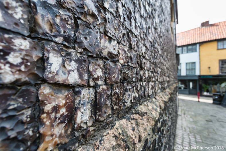
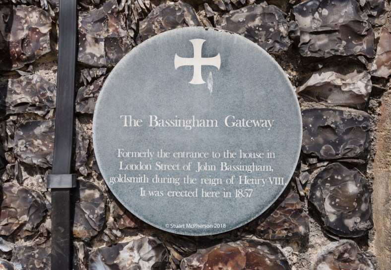
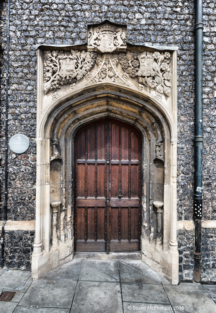
Bassingham Road – John Basingham was a goldsmith based in London Street during the reign of Henry VIII. When London street was being widened in 1855 a William Wilde bought (and saved) the ancient doorway for John’s house for £10 and it was subsequently moved into the side of the Guildhall to be retained as part of our City’s heritage. Thanks to Colonel Unthank for the details on this one.
Berners Close – Chas Berners was a land owner in Upper Hellesdon so it’s probably a nod to him. It’s an extension to Berners Street, a road that appeared in the Victorian-era and lined with late 19th Century terraced housing. It seems that not as much thought was put into the road-names for later additions to the estate as the original. I’m guessing the pomp and glamour of the Post-War building projects had begun to wear a bit thin after a rather large recession. Known locally as ‘Beirut Close’ for its poor condition, although Beirut has long-since shaken off that stereotype.
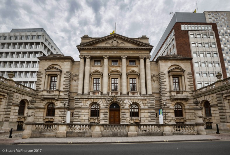
Bignold Road – Samuel Bignold. Who took over running of the Norwich Union Fire Insurance Society and Norwich Union Life Insurance Society. He was also Sheriff of Norwich in 1830 and Mayor in 1833, 1848, 1853 and 1872. Samuel was as also Deputy Lieutenant of Norfolk. His father, Thomas Bignold, was the Founder of the two Norwich Union businesses but also turned out to be a bit of an old eccentric – if the history books are to be believed at least – and he went bankrupt after being squeezed out of the Norwich Union by the board, and his son. Insurance is and always will be a bit of a cut-throat industry!
Blomfield Road – Francis Blomfield was an antiquary famed for recording Norfolk County History and a chorographical record of Norfolk. One statistic provided by his research was that the Bubonic plague killed over 2000 people in Norwich in one year alone (1665/1666). Part of his findings also went into the origins of the village name of Oxnead, see Oxnead road.
Bolingbroke Road – named after either Horatio Bolingbroke, Mayor in in 1819 or Leonard Bolingbroke, a solicitor who saved Strangers’ Hall in 1896 by buying it and then opening it up to the General Public as a museum in 1900. I suspect it was originally named after Horatio, but Leonard’s history is equally relevant.
Bowers Avenue and Close – John Bowers, Famous Norfolk Bishop and Freemason. Held a silver ticket with Great Eastern Railway for his work around the County. Settled in Norwich before passing away in 1926. Did he know he was having a road named after him, or was it named thus in his memory?
Brasier Road – Robert Brasier came from a bell-founding family, was Sheriff and Mayor of Norwich who helped to make Norwich a shire-incorporate. He and John Daniel were made the first Sheriffs of the newly made County of Norwich and three years later he was part of a committee that was elected to raise funds for the building of the new Guildhall, which is still a very prominent part of the City’s historical architecture today.
Bulmer Road – Edward Bulmer, Canon at Norwich Cathedral and a musician. Came to Norwich in 1859. His musical abilities made him a very popular man in the thriving music scene of Victorian Norwich.
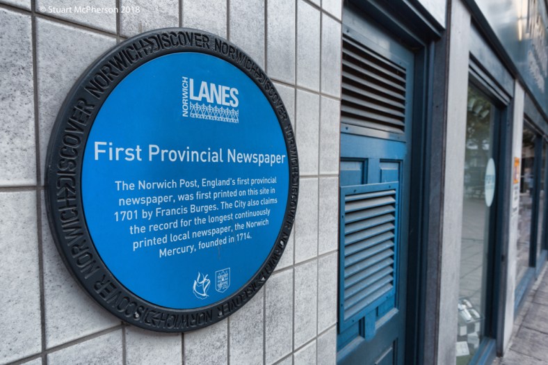
Burges Road – Francis Burges, Printed a provincial newspaper from an address on or in the vacinity of Castle Street in 1701 named: The Norwich Post. This paper is believed to be the first provincial Newspaper to be published in the UK outside of London.
Chambers Road –William Chambers, Sheriff in 1834 and that is all I can really find out about him.
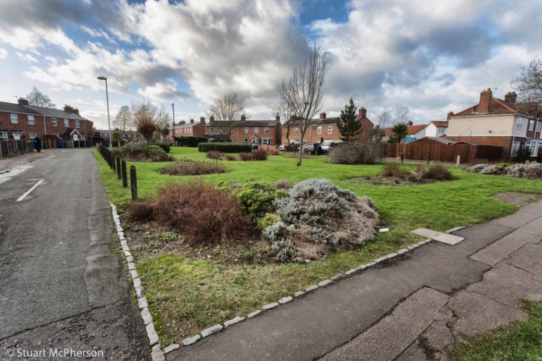
Civic Gardens – Highest Civic office was Mayoralty. I’m guessing at this one, but it was most likely named in the flavour of the times, a sense of ‘civic duty’ perhaps, or maybe named after the concept of a ‘Civic Center’ which would be a community focal point, being located where it is slap bang in the middle of the estate’s focal point (on a map at least), Appleyard Crescent. Or maybe it was named as such as a nod towards ‘Civic engagement’ and the feeling for the residents of being connected with new local community. Or maybe it’s a mixture of all of the above, but it feels like a very ‘Corporation of Norwich’ way of thinking.
Dowson Road – John Dowson, a Solicitor and Educational philanthropist who donated a fair sum of money to help improve and provide a better education for the children of Norwich. I wrote a large piece about the Dowson here: Schooled at the old skool School.

Drayton Road – Like Aylsham Road in more ways than one. One of the busiest roads through Mile Cross was named purely after where you’d eventually get to if you travelled along it. It wasn’t always called Drayton Road though, this name came with the creation of the Estates (yup, plural). Everything on the South Side of Drayton Road was originally known as ‘The Drayton Estate’ for some reason or another. However, before all these houses and estates arrived in the 1920’s, Drayton Road was known as ‘Lower Hellesdon Road’.
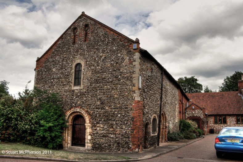
Eustace Road – Eustace Gurney, a member of the famous Gurney Family. He was responsible for restoring the Lazar House Chapel in 1906.
Fenn Crescent – most likely named after a ‘Hugh Fenn’, once Mayor of the Staple of Great Yarmouth and well known in the merchant community of Norwich. In 1387 he had acted as a feoffee of the manor of East Carleton (just to the south of the City) which subsequently came into the possession of William Appleyard (mentioned earlier) and in 1395 he was involved in transactions relating to other properties in the same area. A year later, along with a man named Niche, he took possession of properties and land in the city parishes of St. George and Simon and Jude, and in 1408 he was involved with the acquisition of buildings in the parish of St. Peter Mancroft close to the market-place. Clearly, Fenn had his fingers in many pies and used Norwich as a centre for his trading concerns.
Galley Hill – purely and imaginatively named for its location, running down part of the sprawling Galley Hills. Also the site of one of Mile Cross’s much-missed public houses, talked about in this prevoius blog entry: Galley Ghosts.

Gresham Road – Named after James Gresham from Holt. He appears in the famous Paston Letters where he is referred to as a confidential agent to the Pastons during this period. The Village of Gresham is named as such because of the Gresham Family. Half of the houses on Gresham Road have since been demolished and replaced.

Gowing Court – Most likely named in honour of the Gowing Family of farmers who worked the land across the County and under parts of Mile Cross. A more recent family member was Cecil Gowing, an Aviator and Farmer who served with 98 Squadron of the Royal Flying Corp (RFC) flying de Havilland DH9’s over France in WW1. Shot himself down when warming up his guns on the way to the Western Front. His recently-modified exhaust (to stop his face getting sooty) was rerouted in front of the front machine gun by his engineer and the bullets defelected into the engine, forcing him into a crash-landing. He continued to fly after WW1 and became a member of the Norfolk and Norwich Aero Club flying from their airfield at Mousehold Heath. The Cecil Gowing School was built on the former airfield in 1966, Cecil himself planting a tree to commemorate the occasion.
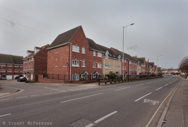
Half Mile Road and Close – Built as a later extension to the estate opposite the junction of Margaret Paston Avenue at Mile Cross Road. Named after the much older ‘Half Mile Lane’ which ran from Drayton Road at it’s junction with Old Farm Lane and up what is now Shorncliffe Avenue, all the way up to – and including what is now – the northern section Mile Cross Road.
Hansard Road – Luke Hansard, Hansard the Printer. Left Norwich to make his name in London with only a guinea to his name and landed a job with John Hughes the official printer to the House of Commons. By 1800 he was running the business by himself. His family name was given to the “Hansard”, which is the traditional name for the official report of all Parliamentary Debates to this day which can be found here: Hansard.parliament.uk/commons/
Havers Road – Thomas Havers, Mayor. All I can find out about his chap is that in 1710 he refused the then 4th Duke of Norfolk permission to hold a processional entry into the city, fearing that it might spark pro-Catholic riots. The Duke, in a huff about it all ordered that the Duke’s Palace (where Duke Street gets its name) was to be pulled down and he then severed all links with Norwich. Get him!
Kirkpatrick Road – John Kirkpatrick of Norwich, a linen merchant and clergyman from Scotland who became treasurer of the Great Hospital. John was also an atiquarian who collated a vast amount of information regarding the History of the City, he also created a detailed, two sheet prospect for the North East of the City. His work was never completed and only came to light after he passed away. Extracts from Kirkpatrick’s papers were cited in Robert Fitch’s historical introduction to John Ninham’s ‘Views of the Gates of Norwich,’ published by the Norfolk and Norwich Archaeological Society in 1861. He died in 1728 aged just 42.
Knights Road – Mark Knights, journalist EDP who in 1887 wrote the much-loved (by historians) “Highways and Byeways of Old Norwich”, which was a ‘a descriptive ramble through Conisford, the new Burg, Westwick, Northwic and Tokethorpe, Wymer and the Liberty of the Prior and down the Wensum. I really should make a bit of time to head off to the Heritage Centre and have a proper look at it as it sounds like it would be right up my street!
Lefroy Road – William Lefroy was the Dean of Norwich for 20 years as well as being an overseer of extensive restoration work at the Cathedral. Little did he know his name would become the home of an entirely different set of Towers. None of the original homes along Lefroy Road survive after being demolished in the 1980’s.

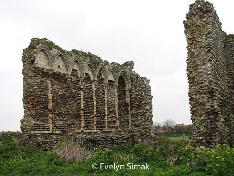
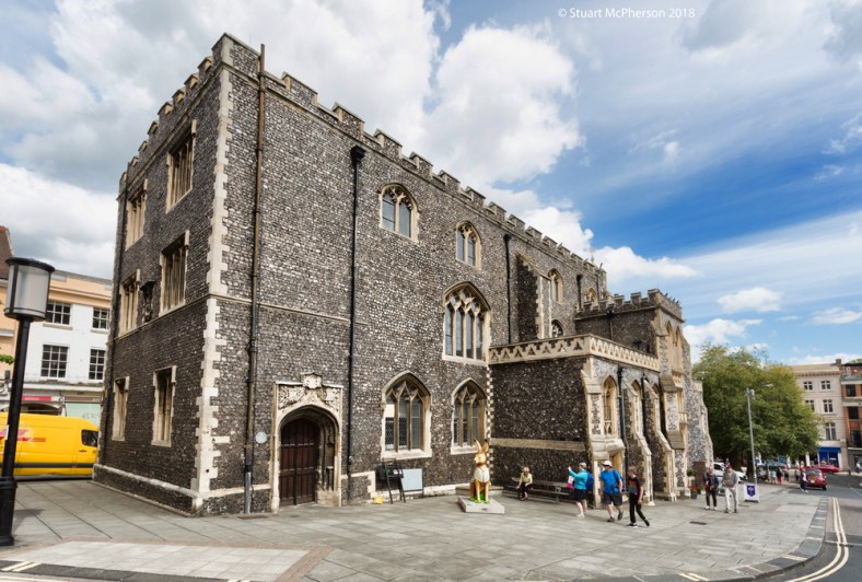
Losinga Crescent – Herbert de Losinga invited to England from Normandy by King William Rufus, He became first Bishop of Norwich, founded the Norwich School and the Lazar House Leper Hospital (pictured earlier above) some time before his death in July 1119. He was buried before the high altar of Norwich Cathedral.
Margaret Paston Avenue – A sign of the times that this was the only road named after a woman. Margaret Paston was born in 1423 and was the daughter of prosperous landowner. In 1440 she married John Paston, the son of an even wealthier landowner named William Paston. Margaret was often left in charge of John’s business and properties and on more than one occasion had to endure holding down the fort whilst armed forces seized various properties belonging to her husband. Whilst Married to John, Margaret wrote a total of 104 letters. Those letters and there responses survive to this day and serve to give historians a fascinating insight into that period of time as well as giving a personal insight into her state of mind, relationships with her family and plenty of interesting events that occurred during that period. She died in 1482, some 16 years after her husband.
Marshall Road – John Marshall. This Gentleman was twice Mayor of Norwich. Once in 1828 and again in 1841.
Mile Cross Road – Obvious and maybe not so obvious. Having a Mile Cross Road in Mile Cross seems like a no-brainer, however, the road existed before any of the houses. Maybe the building of Mile Cross Road bridge and its road in 1923 was done so in anticipation of the building of the new housing estate, but it also happened to take you directly to the ‘Mile Cross Inn’ which had stood in Upper Hellesdon since the early 1800’s. On more of a personal note, this road tried to kill me twice when I was a youngster. A car speeding down the hill towards the roundabout knocked the shoe off my trailing leg as I ran across the pedestrian crossing between the parade of shops and a few years later I wrote off a Ford Cortina with my hip as I ran across the top of Mile Cross Bridge.

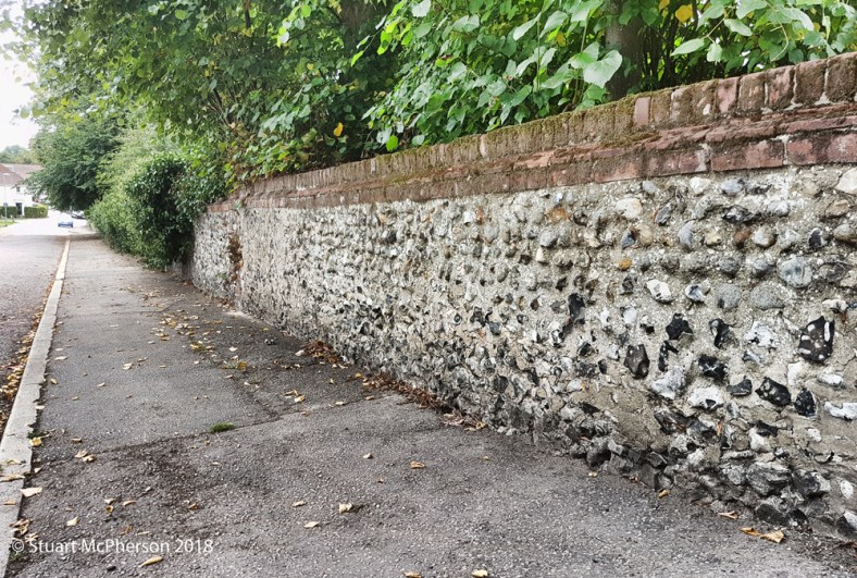
Old Farm Lane – This road predates the estate by quite some time. Named after the Farm that sat on the patch of land behind the old Manor House that used to occupy the site of Lidl. Interestingly, the Farm was listed as the ‘Old Hall’ in the 1880’s and I may have to research this properly at a later date. The Farm occupied a large piece of land at the end of Old Farm Lane, roughly about where Havers Road now runs through and stretched from here, across what is now housing (formerly Harmers clothing factory) and all the way down to the railway line. The Farm (and Hall) had its own an occupational crossing installed by the L&F Railway, presumably to allow cattle access for grazing in the flood plains now covered over by Anderson’s Meadow. It appears that the farm was swept away by time in the 1930’s but traces of the site’s history are still visible in the form of an old flint wall that lead down towards the farm.
Oxnead Road – Named after the Oxnead Estate, or Oxnead village which was the principle residence of the Paston Family. Like a lot of the Paston connections on the estate, this road is connected to Margaret Paston Avenue.
Press Lane – Presumably named after the use of a Windmill to press oil. There was a substantial Windmill located here for some years as talked about in this earlier blog entry.
Parr Road – Samuel Parr, elected master of the grammar school of Norwich before he became curate to the Reverend William Tapps, serving the churches of St. George’s Colgate and St Saviour. He was also a writer, minister and Doctor of Law. He was known in his time for political writing as “the Whig Johnson”.
Peterson Road – Another short and sweet one; named after Spencer Peterson, another Sheriff of Norwich from 1601.
Pinder Close and Road – Thomas Pinder was the Headmaster of two Norwich Schools in the 19th Century.

Red Cottage Close – named after a small red Cottage that stood on a triangle of land by the junction of Hellesdon Hall Road and Drayton Road, roughly where the car park for Sloughbottom Park now sits. I wish I knew more about these cottages, but the details are scarce. They may have been connected to the pit or quarry located directly next to them.
Ropemakers Row – A long and thin slice of land along Drayton (Lower Hellesdon) Road where the Wensum View housing estate now stands was a ‘rope walk’, a place where the materials for rope were laid out before being spun into rope. The Ropemakers Arms dating back to the 1850’s stood on the opposite side of the road before becoming the James the 1st.
Rye Avenue and Close – Walter Rye was originally a solicitor from London but became Mayor of Norwich in 1908. In his earlier years he was a famed British Athlete, pretty much inventing the sport now known as ‘Cross-Country Running’ as well as being a writer for the ‘Sporting Gazette’. On top of all that he was also a valuable Antiquary, writing over 80 pieces of work on the history of Norfolk and helping to save many Historic Norwich buildings from being demolished.
Shorncliffe Avenue – not too sure on this one. The only Norwich connection I can find so far is that of The Norwich 7th Battalion (part of the Norfolk Regiment) moved to Shorncliffe Army Camp before heading off to fight on the Western Front.
Soleme Road – Anthony de Solempne was refugee from Brabant in 1567 and was the first Printer in Norwich located in Dove Street, he also traded wine from the continent and was a very wealthy “Stranger”. Comin’ over ‘ere, etc.
Spynke Road – In the 1330’s Richard Spynke was given a contract by the city to complete the City Walls. He spent seven years and some of his own money to ensure the project was finished. Part of his contract was that the city was responsible for ensuring its residents would not use the city walls to dry their cloths on.

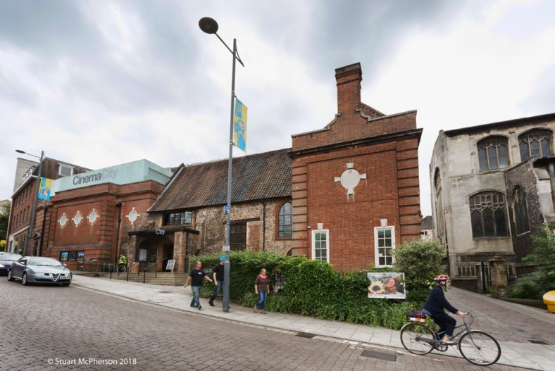
Suckling Avenue – Robert Suckling, twice Mayor and the Sheriff of Norwich in the 16th Century. Bought and rebuilt a house on St Andrews Street known as Suckling House, or more familiary known these days as Cinema City.
Valpey Avenue – Edward Valpy, Headmaster of the Norwich Grammar School for 19 years. One of his pupils was the well known writer George Borrow. He left working as a headmaster to become rector of All Saints Thwaite, and Vicar of St. Mary, South Walsham.
Wheeler Road – Francis Wheeler, Headmaster Bracondale School. His son was shot in the head and killed on his first day in the trenches at Ypres.
Woodward Road – Samuel Woodward Geologist and antiquary, author of a number of books, including “An Outline of the Geology of Norfolk (1833)”.
So there you have it, it’s amazing what you end up digging up when being curious about what your road name actually means and I also think it’s an intersting window into the mindset of the the Norwich Corporation’s (Norwich City Council) in the early 19th Century. A lot has changed between then and now, especially with concerns to building much-needed housing for the masses. It’s also seems that there is an apparent lack of pride from those who now govern this city, (mostly due to a severe shortage of funding) and what strikes me particularly the most is that it seems the people in control of running our once-fine city had a better vision for it back then than they seem to have almost 100 years later. I guess this is what we call progression, 20th Century style.
Thanks once again for reading,
Stu.

Great idea for a post, Stu. It’s good to see the redoubtable Margaret Paston honoured by a street name. But it would be wonderful if Harriet Martineau ([one of] the first women to earn her living by the pen) could receive the same treatment.
LikeLiked by 1 person
There is a Martineau Lane in Lakenham. I has always assumed that road was named after her.
LikeLike
I have really enjoyed reading about the history of the street names, thank you
LikeLiked by 1 person
Really enjoyed reading how all the Mile Cross roads got there names. I lived in that area from 1946 and used to play a lot over the Galley Hills before it was all built over. As regards Red Cottage Close, I remember the piece of land before it was built on. There was a Police house on the corner of Valpy Avenue and Drayton Road, behind that was a large pit, and about where you described it was a small flint cottage which had all the window frames and doors painted bright red. Above the door on a long piece of wood was carved the name , ” The Red Cottage”. I believe there was only this one Cottage.
LikeLiked by 1 person
Hi Les, thanks for the info, it’s fascinating stuff. Where did you live, and for how long?
LikeLike
Interesting read, guessing you couldn’t find anything on my road, Glenmore Gardens? It’s the road just north of Half Mile Road, accessed from Aylsham Road by the bank and opposite Mecca Bingo.The only thing I know about it is that half of the street’s houses were built in the 1930s, with the newer ones (one of them being mine haha) built in the 1950s. My dad told me there apparently used to be a brewery down here, and when digging in the garden we would often find bits of glass bottles. Cheers, Michael.
LikeLiked by 1 person
Hi Michael,
I can tell you that it was originally allotments until the first batch of houses were built, which were private. The later houses and flats along the southern loop of were built as council homes. The area to the east of of Mile Cross Road was actually referred to as the Mill Hill estate, presumably because of its valley side location and the fact that the area to the north was home to a number of Mills. I also suspect that Mile Cross (or myle cross) is named after Mills and not miles.
Regards,
Stu
LikeLike
It is `Mile Cross’, named after the crosses, not after mills. These were installed when the boundaries of the City were expanded in the mid-sixteenth century. The remains of the plinth for the cross that once stood at what is now the junction of the ring road and Aylsham Road is in the car park of “The Boundary” pub (and no doubt the source of a few dents!) It was knocked down by a lorry in 1924.
There are two Hellesdon crosses. One stands on the road junction in front of Asda. It has moved around quite a bit. In the 1960s it stood in the middle of the roundabout that was later overwhelmed by traffic and replaced by the present junction.
The second Hellsdon cross is in the churchyard of St. Mary’s Hellesdon. This was necessary because the division between the newly expanded City and the county ran through the churchyard.
Looking in the other direction another cross is twenty miles down the river Yare at Hardley. This marked the boundary of the City’s jurisdiction over the river. In order to assert the City’s jurisdiction over the river the mayor and aldermen used to sail down the river once a year to hear a sermon at this cross: not so much beating the bounds as splashing the bounds!
Although they served a civic and jurisdictional purpose they came out a much older tradition of erecting crosses that provided foci of devotion in pre-Reformation religious practice. Many of the churchyards in the City had these crosses. Also, there was one adjacent to Earlham bridge. These were often situated at boundaries or crossings and one can see how this custom was adopted when the City wished to mark out its newly expanded boundaries.
They all seem to have been rather tastelessly restored c.1902.
I much enjoy your blog, especially the personal recollection and oral history that you record. The physical expansion of the City in the interwar years as represented by Mile Cross Estate is an important part of its history and the counterpoint of the clearing of the slums in the city centre. It was inspired by the garden city movement and the open spaces were an integral part of the development, as well as being part of a job-creation programme. You are quite right to bemoan the loss of civic initiative which is a result of the reduction of the City to the status of a district council: an outcome of the reorganisation of local government in 1974.
LikeLike
I’ve already written about the crosses, here: https://themilecrossman.com/2018/04/22/crosses-for-miles/
The origins for the name for ‘Mile Cross’ is still up for debate. I’ve seen it referred to as “Mill Cross”, “Mille Cross” and “Mylen Cross”. None of the crosses are a mile away from each other or the City Boundary, and I hope to get to the bottom of this ‘mystery’ when I get to delve into the archives for part of the MX100 research group.
LikeLike
From 1979-1986 we lived at 30 parr road, I was 6 years old when we moved out to the what was beautiful number 9 losinga crescent it was a gorgeous 4 bed house with sash windows overlooking the bowling green on the tree lined crescent,we moved out that home in the late nineties never to return to the estate, but I will always be proud to be brought up in such a beautiful home, thanks for the memorys, also I really miss the gally hill pub
LikeLiked by 1 person
Thanks for a very interesting insight into an older Norwich and it’s origins.
LikeLiked by 1 person