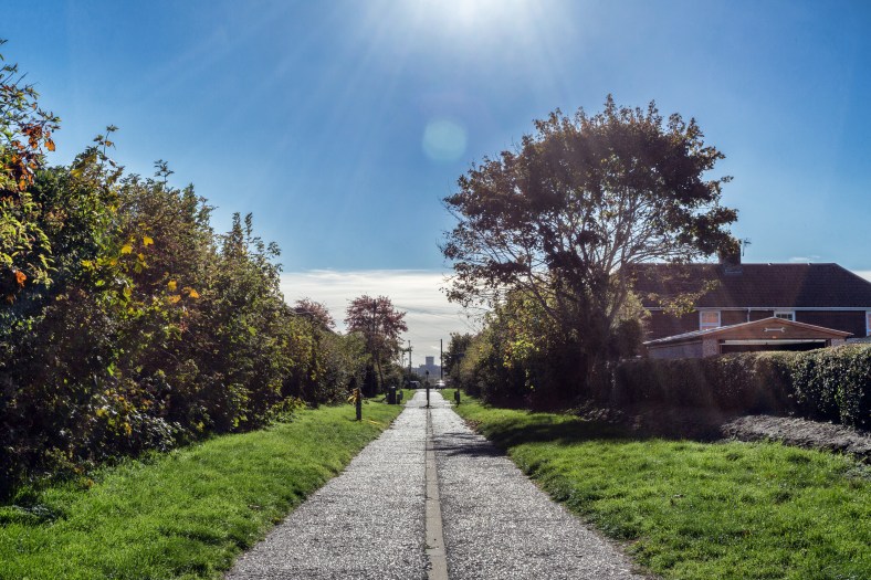
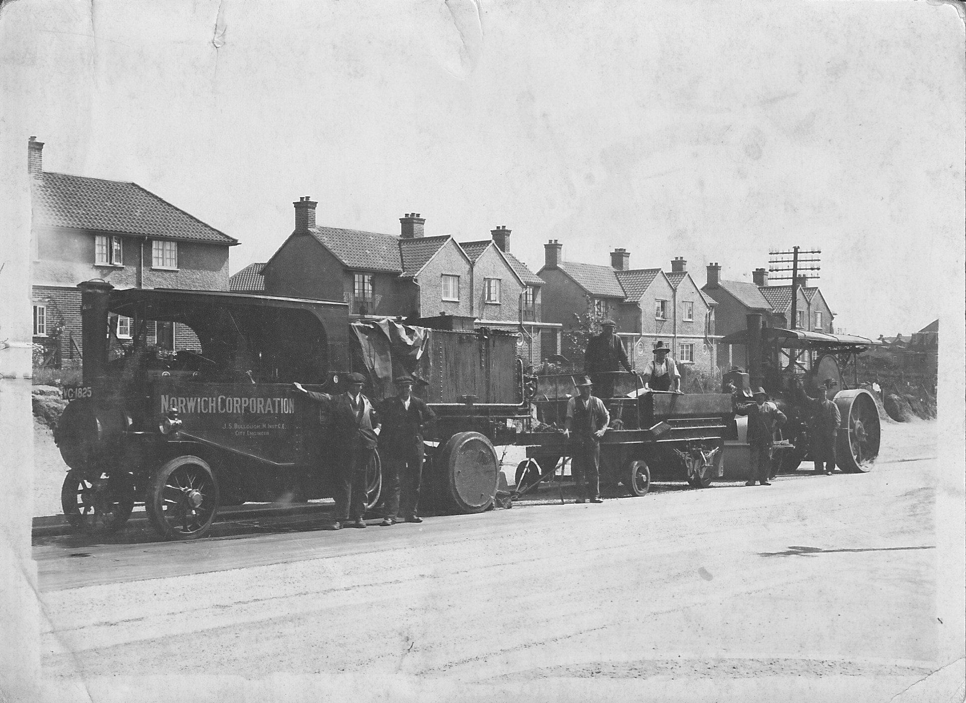
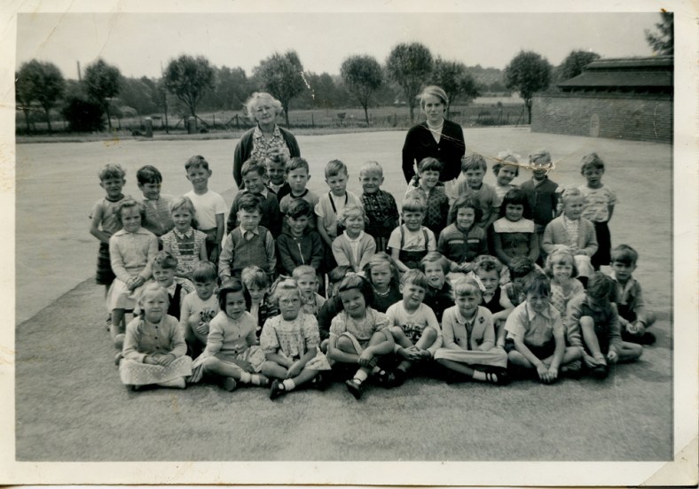
An old farmer’s lane gets me wondering.

I wrote a piece some time ago now about the names of the roads here on the old estate and the possible/probable thinking behind them, and there’s one road in particular that stands out for me above the rest. It stands out not because it’s named to echo the memory of a famous person who once frequented the streets of Norwich eons ago, or out of some sort of pride-fuelled 1920’s civic duty. This particular road name is purely a nod to what was here, in this exact spot long before the estate and its rows of lovely new houses appeared on the scene. This is a lane where the path has been well-trodden by footsteps for centuries. This particular road formed part of a much-longer road than it does now and occupies the southern-most stretch of the only road that cut from north to south across what we now call Mile Cross. Other than the two main trunk roads (Aylsham and Drayton) that now border the estate as they head in and out of old Norwich, it’s probably the oldest road on the entire estate. The road I’m talking about is a short little road, now closed off at one end, just next to the entrance the nineties Lidl Supermarket on Drayton Road, and it’s named “Old Farm Lane”.

Old Farm Lane, seen from the bottom. Looking North.
Continue reading “An old farmer’s lane gets me wondering.”

The Inner-Link makes its mark and the end of City Station.

Going on from the last piece I wrote at the end of 2018 about Anglia Square, I was recently reminded of a Saturday afternoon back in 2011 when we were working on the Norwich City Station site as part of the Friends of Norwich City Station (FONCS) project. An elderly gent had come along to view our progress and he had brought along with him an envelope containg a handful of old negatives that he’d taken when he was younger. He said that they may be of some interest to us and kindly allowed me to borrow them, I just wish I could remember his name.

After I’d had them scanned I could see that they were taken throughout the 1960’s and were all taken in and around the City Station area, whilst the roads and buildings were being cleared in anticipation of the answer to all our dreams: The Inner-link Road. This road was about to be laid right through some irreplacably-historic parts of old Norwich, almost encircling the entire city as it went, like a really crap version of the City Wall. It was also going to go right over the top of the now-closed railway terminus made famous by the much-missed Midland and Great Northern Railway, the remains of which us dipsticks decided to try and dig up some half a century later.

blog5

Continue reading “The Inner-Link makes its mark and the end of City Station.”

What’s in a road name?

The Mile Cross Estate has some very interesting road names from a historical point of view so I thought I’d take a closer look at the history behind those battered old nameplates to try to ascertain what all those names mean and why. As it turns out most of the road names read to be a veritable “who’s who” of famous Norwich Citizens, albeit from an early 20th Century viewpoint and with a few Paston Family related place-names thrown in to the mix. I decided to take a look at most of the road names in what I call the ‘original’ part of Mile Cross as a Corporation-built Estate along with a few just outside of those now imaginary boundaries. The following list is what I have managed to come up with. Some of them were fairly obvious and easy to research but some were a little harder to figure out. I’ve tried my best to be as accurate as possible when it came to the naming conventions being applied in the early 1920’s but even if I haven’t necessarily found the correct person for the name-plate, the historical points made below are still legitimate and hopefully make for some interesting little glimpses into the past of our fine City:

Appleyard Crescent – William Appleyard was 3 times sheriff and 5 times City Mayor. William was the first Mayor of the City after it became a shire incorporate in 1404. He owned a lot of property in the City and Inherited from his father the house that now incorporates the Bridewell Museum, famed for it’s finely-cut black flint bricks. William presented the City with a great tree to aid with building the new Guildhall. He also owned a lot of land to the South of the City, including Intwood, Bracon Ash and Hethel.
His father was given the rather odd responsibility of providing the King with 224 Herring Pasties whenever he visited the region.

RN4

Continue reading “What’s in a road name?”

Drayton Road

I recently stumbled across three fascinating images taken along the section of Drayton Road stretching from the Lidl roundabout to the junction at Asda. I’ve covered Drayton road fairly comprehensively over the course of this blog and those stories can be found below (all worth a read if you haven’t already):

Nigel Neale

The Dolphin Tragedy

Retail Therapy

Chalk and Putty

The Slough and the Knight

Shoes to shoe boxes

Little bits of History

Topography to the Point

So in this short entry I’m just going to share the images in question and go into a little bit of detail about what we’re looking at one by one.

I’ll start off with this fascinating image kindly provided by Don Thorpe:27709613_10156190490998793_7938530565865381547_o Continue reading “Drayton Road”