Sweet Briar marshes are both close to my home and close to my heart, situated less than five hundred meters away from my back garden and a place I loved exploring as a child. They’re a place where you can escape to and forget that you live within an ever-expanding city, seemingly intent on gobbling up all the lovely green bits that surround it. It’s also often fondly remembered by some of the veteran Mile Cross residents who would sneak across the railway lines, avoiding the railway police and the farmers to indulge in some dyke-jumping or to collect tadpoles. At thirty-six hectares the marshes are relic of the wet meadows that straddled the rare chalk stream named the river Wensum (which is the Anglo Saxon word for winding) all the way from its source out at Whissonsett in a remote part of the UK’s driest and flattest county, to it’s confluence with the river Yare just east of the city. There are only 210 of these rare chalk streams in the world, of which 160 (73%) are to be found here in the UK, many of which can be found right here in Norfolk. The largest being our very own river Wensum, which also happens to be one of the finest examples in the country. The Wensum glides by the southern edges of our estate from Hellesdon, entering under the fairly recently added Sweetbriar Bridge of 1933, before opening out nicely as the Sweetbriar and Mile Cross marshes right on our doorstep. From there it meanders at a leisurely pace right into the centre of our city, creating a little slither of green, an unusual little oasis of nature right up until the point it drops into the city (literally) over the sluices at New Mills Yard. From here on in the river is once again tidal as it merges into and rather confusingly gets consumed by it’s smaller sibling, the River Yare, which then transports the ghost of the Wensum all the way out to sea at the Yare’s mouth or Great Yarmouth. Wouldn’t ‘Great Wensumouth’ sound much better? From here it makes its way back into the atmosphere only to be dumped on the land once again upstream to start the whole cycle all over again.
To me the marsh was up until recently, a secret sanctuary, a fenced off area of mystery, that even though I had been a visitor to many a times from the 1980’s onwards, there were parts of it that I had never dared venture into, and with good reason; it’s not very accessible and quite possibly a dangerous place to be wandering about in, especially the marshier areas down past the transitional ecotone borders between chalky valley side and the marshy valley bottom. It’s this inaccessibility that helps to keep the Marshes wild and mostly untrodden and I doubt that many people have actually walked the marshier, northern edges of the Wensum here over the centuries particularly on the western side. Not even the generations of farmers who farmed these lands would have much call to wander into the depths of the marshes without good reason, although there is evidence of human intervention, particularly in the network of ancient dykes that were put in to help with drainage. The fact that these marshes have been so untouched for so long, particularly when you take into account that at it’s widest point the marsh is only about 500 meters wide and located only barely over a mile away from the city walls, helps to make this a fascinating and rare landscape, not just here in the UK, but globally. The unofficial paths that had been tread by the locals for years are all actually north of the ecotone on slightly higher ground, and not too far from the busy Marriott’s Way, where you never felt fully immersed in the mystery of the marshes themselves.
We’re lucky that the marsh still exists at all, as over the years the valley bottom has been in-filled from the city centre outwards, particularly from the edges of the former City Station, which itself was built upon an Island of sorts. If you stop and look at Anderson’s Meadow for a moment, you’ll see that it is actually a raised hump, a covered-over over post-war dump, which was then extended across Mile Cross Road and out as far as Sloughbottom Park, where you can actually see the edge of the infill, the land dropping a good 10 feet at the edge of the marsh.

If you’re brave enough to clamber down the side of this man-made slope and dig into it, as my friend Matt Williams once did, you’ll find all-sorts of man-made detritus just beneath the surface. Matt found bits and pieces of old housing, including window frames and old tiles, which most likely came from the Blitz clearance, and all sorts of glazed china and pieces of household objects. For years after the war the valley bottom was simply seen as a rather handy place to just dump our rubbish and rubble and flatten it out to make sturdier ground to put industry on top of. Swanton Road is essentially built upon a tall mound of rubbish sticking out of once-lush river meadows here.

Thankfully, this process was stopped just in time and our marshes and their vital ability to drain the city and to provide a haven for wildlife were mostly saved. However, the onslaught on the marshes didn’t stop there and in the 1950’s, a large swathe of the northern valley side was sold so that the construction of massive chemical factory could commence. This site was, and still is, huge; running alongside the entirety of the western side of the marshes. The marshes, river and chemical processing plant haven’t always existed together in harmony, and in the past there have been serious pollution incidents caused by activities at the site. Thankfully, this relationship has improved over the years and the modern running of this chemical plant has improved significantly as they worked together with the environment agency and Anglian Water to clean up their act. This understandably secure site with it’s tall fences is now – in places – a bit of a nature reserve in it’s own right, particularly the wooded areas just opposite the marsh, where some rare species have made these fenced-off borderlands their home. All that said its pungent smells, now a lot better than they used to be when I was a kid, can still catch your nostrils if the wind is blowing in the wrong direction, helping to emphasize the ever-increasing importance of this ancient marsh and how it lives on a knife-edge as it increasingly becomes under siege from the urban sprawl of the modern world surrounding it.
What is left of the wet grassland meadows is interspersed by old dykes that were put in by generations of farmers to help drain the land and to make it easier for wetland grazing, an area that farmers often used to fall back on during the drier months. Thankfully, the drainage here hasn’t been too harsh and the marsh still retains some of its original wet grassland qualities, even more so now it is no longer used for agricultural purposes and has been left (and managed) to enable it to evolve into a more natural reserve.

For years the land here was part of the Gurney estate before being put up for sale, primarily for use as arable grazing grounds. Thankfully, and since the infilling of the valley was halted a few decades ago, the people of Norwich had come to realise how important this habitat was for – and indeed an asset to – the city and beyond. So a public appeal and fundraising campaign was launched to be enable its purchase, with the goal of protecting it and to turn it into a much-needed city nature reserve. In record time, GBP300,000 was raised, which was then matched by one of the larger supporters of the Norfolk Wildlife Trust, giving an impressive total of GBP600,000. The land was subsequently purchased and taken under control of the Norfolk Wildlife Trust who have since opened it up to the public, primarily focussing on making it accessible for the local communities that live alongside it.
Having delved into the history of the site, I can see that in ‘modern’ times, from at least the 1600’s onwards, this whole area out to the west of Norwich was farmland and heathland, but the maps can only tell us so much as they don’t really go back far enough to paint a decent picture long term. Luckily we have evidence of human activity extending a lot farther back than that due to rich archaeology found in the area, particularly on, or right next to, our marshes. But before I delve into the fascinating finds that were hidden out of site and only discovered by digging or by chance, there are a few hints of how this landscape was formed even further back than that, which we can still see with our own eyes, today.
If you take a look at Google Maps, or better still go for a walk down the marshes, you’ll soon discover a collection of ponds that run along the borders of the ecotone, and these ponds are believed to be ‘Pingos’. No, before you ask, they have nothing to do with an annoying penguin made out of plasticine, but are a collection of small ponds that run alongside the edges of the marshier land. These pingos, also known as kettle ponds, were formed when the retreating glaciers from the last ice age left behind massive lenses of ice which had been pressed into the ground. As the glaciers retreated northwards, these ice lenses melted, creating these depressions in the ground that then filled with water to form ponds. Unlike other pingos in Norfolk, these are not spring fed, but are controlled by the height of the water table at the bottom of the valley here, meaning sometimes they’re dry, and sometimes they’re quite deep. These pingos hidden in the trees, when full of water, can be a photographers delight, especially when they reflect the old oaks that surround them.
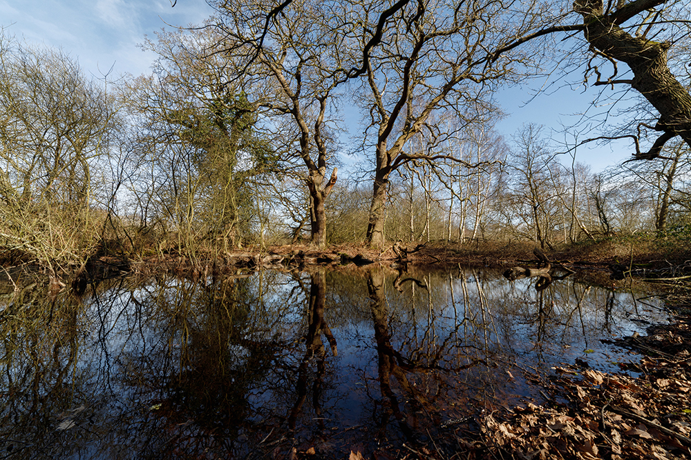
I often stop here to capture a few pictures when I lead my Norfolk Wildlife Trust Photo Walks across the marshes (keep an eye on their website if you’d like to attend the next walk). Now if you consider that the last ice age retreated back northwards about 11,300 years ago, at the start of the Mesolithic period this means that these depressions are of important historic interest, especially when we remember that all of this ancient landscape could have oh-so-so easily been brushed aside, or simply swallowed up by an ever-expanding city, forgotten and never fully understood. These ancient ponds and the marshes that they’re imprinted into should be treasured by those who choose to visit them and breathe in all of the mysterious history surrounding them. I once visited at night to take some moon-lit shots of the pingos and the place felt almost magical.

Now back to the archaeological finds that were found directly within the modern-day boundaries of our marsh, of which there are nine notable finds. These include Prehistoric, Mesolithic and Neolithic flint finds, including multiple worked flints in different locations, a post-medieval bodkin and even a Roman coin. Quite the haul from quite a relatively small area, and who knows what other secrets are hidden here in this ancient, wet landscape. There were also many other similar finds nearby, all not too far from the river as it winds its way into the heart of Norwich. Just to the north of the site and under under what is now the Sweetbriar industrial estate, a ring ditch was excavated in 1982, which uncovered some iron age pottery. These ring ditches were all that were left of a former burial mound known as a barrow, which had been farmed flat over the centuries. The history of this particularly significant site is remembered by a small, industrial dead-end close named ‘Barrow Close’, roughly 200m north of the marshes. So it’s pretty obvious that humans have been active in this area long before the city of Norwich became a settlement, and I they would have been here for the wet and fertile lands provided by the river as it carves its way through the ancient chalk and eastwards towards the sea. The topography, created by the bends in the river and its proximity to the sea is why Norwich was created in the first place.
If you’d like to take a look at what has been found in or around your own neighbourhood, I fully recommend taking a look at the Heritage Explorer website: Norfolk Heritage Explorer map search. Below is a document that I knocked up when researching the history for the ‘Mousehold to Marshes’ piece of theatre, which I’ll probably be writing a piece about in the near future, so watch this space. You can see that the area and its surroundings are rich with archaeological finds, dating back millennia:

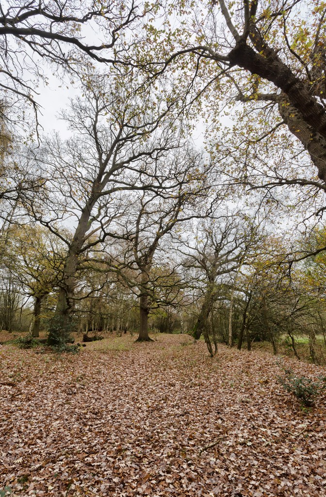
A while back I wrote this piece about Mile Cross regarding the history of our trees, which lead me to discover an old path that was most likely an old drovers path (of sorts) that runs right through the middle of the marshes and possibly served to connect the two nearest farms (one at Old Farm Lane and the other at Hellesdon Barns) to each other and to a plantation of trees that can still be found right in the middle of the marshes surrounding the some of the Pingos mentioned earlier. The path can be traced running from the former farm at Hellesdon Barns to the now long-lost former farm at the end of the modern Old Farm Lane, where cattle would have then been taken along Lower Hellesdon Road (Drayton Road) towards St Augustine’s Gate and into the City Centre for market. This old path runs right alongside some of the larger collection of pingos in the centre of the marsh, in fact this path angles towards them from both farms, and I suspect that this plantation of oak were planted around the pingos as an area to water and feed cattle roughly half way between the two farms. Why a plantation of oak, I hear you probably not ask? In the past acorns were seen as a source of food for cattle, particularly pigs, although it is now known to not be a very good food source for pigs and the tradition slowly died out. This is a great example of the farmers of old seeing the importance of the pingos as a reliable source of water for their farming activities and using the geography of these ancient wetlands to their advantage. This particular plantation of old oak is present on maps well before Sweetbriar Road came through and chopped it (and the marshes) in half. George Plunkett’s photograph of the newly opened Road in 1933 shows the very mature oaks standing tall next to it.

What is left of the old farmers path is lined by old oaks, which were planted along the edges of these old paths to form hedges and so that the roots could create a sturdy surface that wouldn’t keep wearing away, they also helped to raise the path height a little bit above the valley floor which was (and still is) prone to flooding. Some of this old path can still be realised if you know where to look, and when you spot it, it’s a fascinating glimpse into how this area would have once looked long before Norwich burst out from within its flint walls and onto the countryside surrounding it.
This old path predates pretty much every nearby road other than the Fakenham and Dereham Roads. I suspect that this path ceased to function as intended with the arrival of the railway in 1883, which meant that it had to be truncated by a series of farmers’ occupational crossings, disrupting its natural flow, and then further interrupted by the arrival of the outer ring road in 1933 when Sweetbriar Road pretty much cut the marshes in two, right at the point where the ancient plantation stood. Thankfully for us most of the plantation survives and some the mature oak are still going strong for us to marvel at.
One of these old path-side oaks that had started to lean on the soft edges of the path as it got taller and heavier, fell during a recent storm and for months it looked as though it had died, which was a shame, but a fallen oak like this is still a great spot for nature. However, on a recent walk we discovered some new shoots emerging from its fallen trunk. These new shoots will eventually form wonderfully-named ‘phoenix’ trunks and this old tree will continue to live here in this ancient landscape, which is great to see also the perfect example of how resilient nature can (and has to) be.
Whilst on the subject of oak, there is a rather impressive one standing on the western side of the marshes – possibly the largest tree on the entire reserve – that has an impressive circumference which helps us to try and date it. Oak trees are notoriously hard to date as there are so many factors to take into account, but the circumference alone tells us that there is the possibility that this tree could be at least 500 years old, give or take a century. Imagine that, this old tree could have been an acorn or a sapling here when Henry VIII was in power and possibly provided the acorns for many of the other trees here on the marshes. If you get the chance to visit the marshes, I recommend you go stand underneath it for a few moments and imagine the stories it could tell you if it could talk. During the research period for the ‘Mousehold to the Marshes’ I wrote a crude poem (I’m no poet!) about this tree and how it didn’t want to be called ‘Henry VIII’ (long story). Somehow this poem helped to influence the creative writers, and this tree, or a version of it, is one of the main characters of the play; a wise-old oak who tries in vain to shepherd humanity in the right direction.

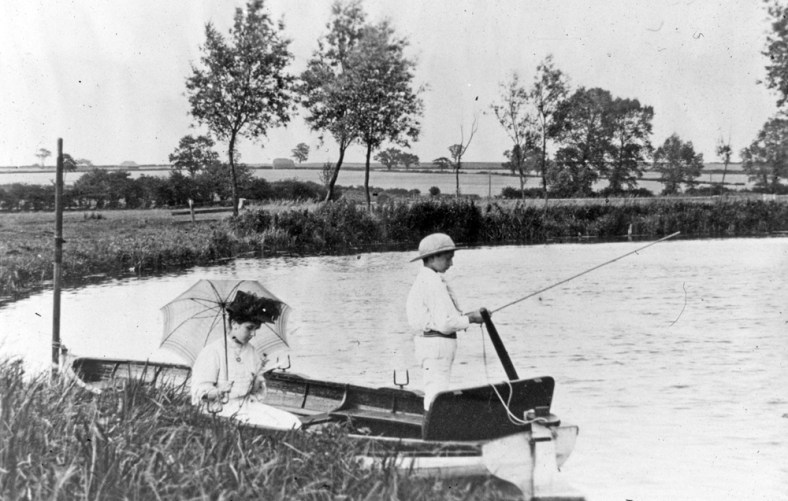
This old path must have been used by farmers for centuries who would have been used to the peace and tranquillity of this land right up until it was interrupted by the dirty and noisy steam trains when they finally arrived here in 1883. Not that the sounds of the railways would have been entirely alien to this valley. To this day you can still occasionally hear the sounds of railway activity at Thorpe as it bounces up our valley from the city if the wind is particularly still and this must have been more pronounced back in the 1850’s when everything was a lot quieter and rural than it is today. In the fantastic image below, dating from from the early 1900’s, we can make out the oak-lined path where it was first cut in two by the railway. Note the gap in the trees and hedgerows just above the boy’s head. Mile Cross would soon be built on the fields in the background, and we can also see the beginnings of the marsh we know today on the left, just above the lady’s umbrella:
Interestingly, a member of the Common Lot, on a recent visit to the marshes during the research phase of our ‘Mousehold to the Marshes’ production, stumbled across the tip (or Ploughshare) of a Victorian plough just sticking out of the soil here, which was a brilliant little find, helping to serve as a reminder to the history of farming on or next to the marshes here. This plough probably belonged to Farmer George Gowing of Hellesdon Old Hall Farm which used to be located at the lower end of Old Farm Lane and under Havers Road.

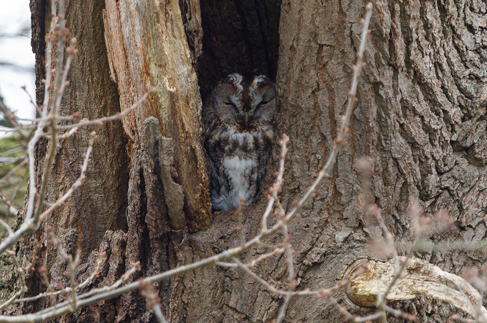
Now that we better understand what these marshes are about; how they’re vital to our city as one of its remaining green lungs, a vital carbon sink and flood sponge that also enable the Wensum and its ever-shrinking slither of green to somehow pierce the city’s armour, we should now understand why they’re more important than ever. This vital space is hemmed in by development on three sides, yet still brings the impression of the open countryside right into and through the city’s boundary, it also serves as a reminder of how the entire area looked before humanity really started to make an impact on the open countryside well outside the city’s defensive walls and ditches. If you’re lucky, there’s even the odd occasion when Sweetbriar Road falls quiet for a few moments and you can here the wind blowing through the leaves in the trees; the birdsong (they actually sing louder to compete with the traffic), the bark of a distant deer, or the hoot of an owl, and it allows you to be briefly transported back in time 500 years or more, until the illusion is shattered by an ambulance as it tears down Sweetbriar Road, bringing you back into the future with a bump. Still enjoyable none-the-less. It’s vital that we remember that it’s not just a place for us humans, too. In fact we needn’t be there at all, and we should remember this whenever we visit and treat the marshes and its inhabitants with all the respect it deserves. These marshes are a vital sanctuary to hundreds of species of flora and fauna that have long since been evicted from the surrounding land that they used to take for granted, and we should do everything within our power to encourage them back in and to leave them be.
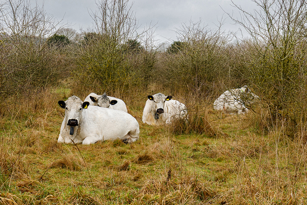
If you’re lucky, you might even spot the small herd of rare breed British White Cows, six in total, that have been introduced to the Marsh by the Norfolk Wildlife Trust. This small herd of cows are controlled by GPS collars enabling the trust to direct the cows to parts of the marshes that need grazing, which is a vital part of the conservation works being carried out on the marshes to enable and encourage a varied range of bio-diversities through out the reserve. The cows do the work that would normally require many volunteers, many hours of work to achieve and are having the time of their peaceful lives doing so. I doubt you’ll meet a happier cow in Norfolk than these six lucky beasts.
Now that you know these marshes are here and are now open to the public you’ll probably like to come along and visit them. Thankfully, they’re easy to locate, and very accessible, the main entrance being just off Marriott’s Way behind Sloughbottom Park. There’s also a few gates further along Marriott’s Way towards Hellesdon that allow access, and they’re all signposted up with maps, so that you know what to do when you arrive. Obviously, there’s no car park due to it’s fantastic location, but you can park at Sloughbottom Park, which also has some public toilets, or park on the road on the nearby Sweetbriar Industrial estate, which has a path leading down on to Marriott’s Way at the end of Burnet Road.
I fully recommend that you do come an visit the place, whatever the season, as it really is good for the soul and hidden gem situated right here in Mile Cross and Hellesdon, and if you’re unlucky enough, you might even bump into me with my camera as I try in vain to capture some of the wonderful wildlife on offer here. It’s also worth keeping an eye on the Norfolk Wildlife Trust website (What’s On), as they hold many events on the reserve, including guided photography and history walks led by yours truly.
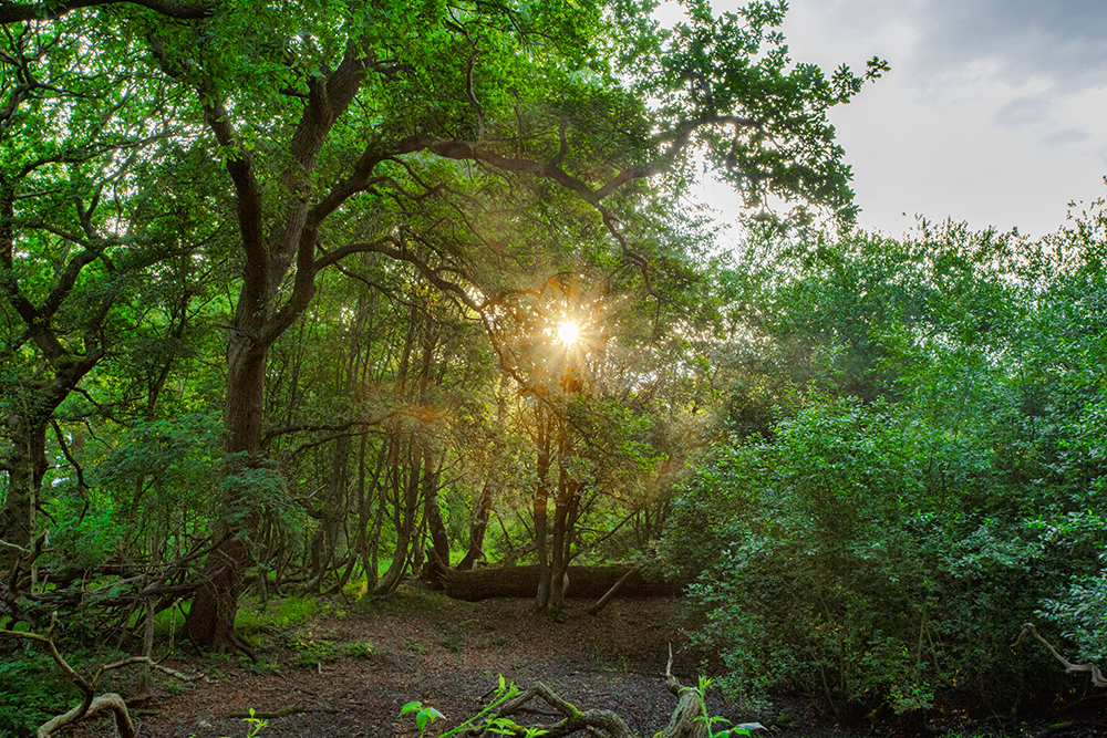
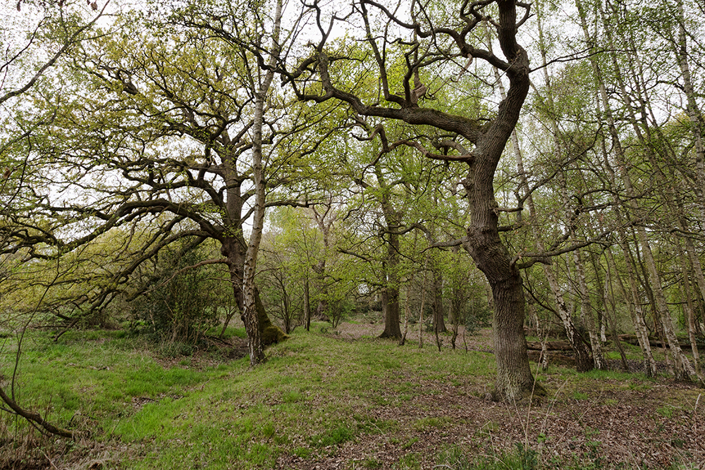
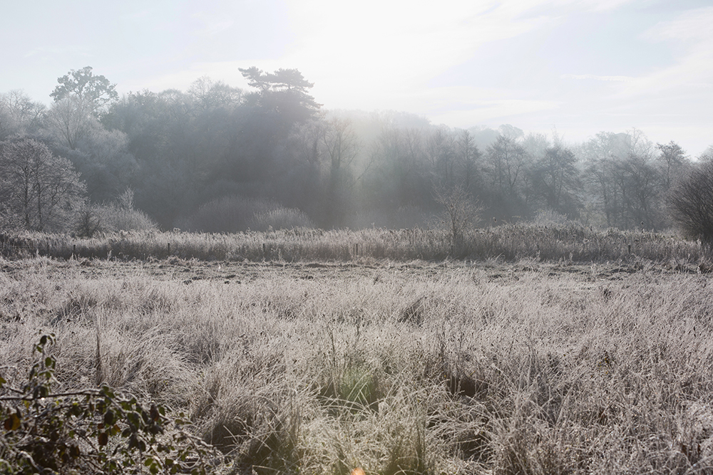
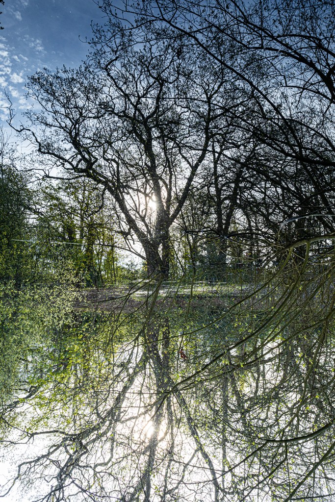
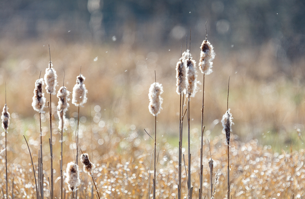
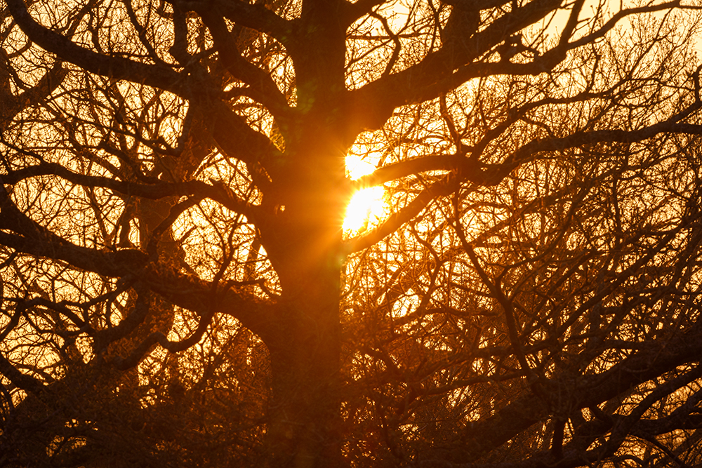
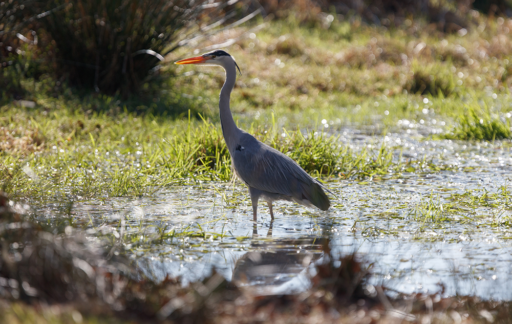
Thanks once again for reading and I’ll leave you with some of my favourite photographs taken on the marshes of late:


Over the next two weeks, the free ‘The Common Lot’ show that I was involved in the research phase of: “Mousehold to the Marsh” will be available to watch at some of North Norwich’s best green areas, the first one kicking off at Peterson Park on Wednesday the 2nd of July at 1930.
I fully recommend you go and catch a show.
The Mile Cross Man (Stu).

It is very interesting to read “there are only 210 of these rare chalk streams in the world of which 160 (73%) are here in the UK, many of which can be found right here in Norfolk. The largest being our very own river Wensum, which also happens to be one of the finest examples in the country. The Wensum glides by the southern edges of our estate from Hellesdon, entering under the fairly recently added Sweetbriar Bridge of 1933, before opening out nicely as the Sweetbriar and Mile Cross marshes right on our doorstep…..creating a little slither of green, an unusual little oasis of nature”.
But, as a Mile Cross child during the middle 50’s, in my days of fishing and swimming in these waters with my dad, I can now lament the passing of my father and also of those pristinely clear waters where I could see the chalky, sandy river bed, and the swarms of fish that I was hoping to catch.
Literally all the river banks stopped at the water’s edge whereas nowadays the water struggles in parts to actually reach the solid bank because of the build up of vegetation and fallen trees and general neglect that has occurred over time and gradually reduced the width and effectiveness of these waters. I used to complain at the weeds flowing down the river (and hooking up on my fishing line) when workmen were cutting riverbed vegetation, standing on opposite banks and manually sawing back and forth across the water with a chain of scalloped blades, and later, using a flat bottomed metal boat with a rear blade, but it all helped maintain the river. Broken branches and rogue growth/bullrushes/etc were removed regularly, all combining to prevent the buildup and deterioration of our waterways and maintain their full capacity and free flowing nature.
I recall puddles and ponds spread over an area of low land on the western side of Sweet Briar Road as it heads down to Dereham Road, and with this slice of wetland acting as a natural floodplain beside the river, I wonder if this might have explained why industrial development didn’t take place between May & Baker (as it was back in those days) and the river Wensum.
In conclusion, I can look back on my memories and reminisce about my childhood of carefree halcyon days (and pretent the future isn’t happening!)
LikeLike
Your memories are not too dissimilar to mine in the 1980’s. That is until one day all the trees died next to May and Baker (Mile Cross Middle’s Cross Country Course) and then the authorities stopped dredging and clearing the river (due to heavy metals). They argue now that pristine banks aren’t as good for nature as messy ones, but I’m still suspicious of that argument…
LikeLike
I certainly remember the trees dying and the pungent odours from May & Baker wafting over Sloughbottom Park and Valpy Avenue where I grew up. I was never aware of any authorities’ claims of heavy metals in the Wensum being given as a reason to stop river maintenance, a fact that wouldn’t appear to have been publicised in the 50’s. In hindsight, had my parents been aware of this claim, then my swimming and fishing activities may well have been reconsidered.
I agree with your skepticism of the authority’s claim that messy banks are better for nature than pristine ones, but I still maintain that by allowing the cross section of the river to become reduced by bankside vegetation and build up of sediment, the actual water holding capacity is substantially reduced and risk of flooding intensified.
In an online search earlier today, ‘Google’s AI Overview’ has thrown up the following facts, none of which I was aware of until now:-
“Defra data indicates the Wensum has high levels of arsenic, copper, and iron.
Mercury contamination was also previously identified as a significant problem.
Heavy metals can be harmful to aquatic invertebrates and other wildlife.
Concerns exist about the safety of recreational activities like swimming and paddleboarding due to contact with contaminated water.
Reports claim the Wensum is also affected by diffuse pollution, including runoff from agricultural land and historical industrial activity at the former May & Baker chemical works having contributed to heavy metal contamination.
Also, the Wensum experiences sewage pollution with reports of discharge into the river”.
You have been warned!
LikeLike