PC Allcock takes a beating

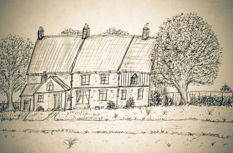
For a couple of my previous pieces ( Old Farm Lane and Sweetbriar Marsh ) I’d been studiously looking into the countryside landscape and the scattering of buildings that were here in what we now call Mile Cross, long before the later housing estate turned up. Whilst poring over the old maps and aerial photographs, searching the landscape for anything of interest, my eyes kept falling upon a little lane that was lost long ago. This little lane was called “Half Mile Lane” and it ran south from Upper Hellesdon Road (now Aylsham Road) down to Lower Hellesdon Road (now Drayton Road), seeming only exist to enable the local farmers to access the many fields that made up our landscape and to connect the two main roads together. Unlike the bloated and expanding city we live in today, Norwich had barely stretched out this far along Lower Hellesdon Road, the only buildings of any merit being the ancient Lower Hellesdon Farm and the pair of old Red Cottages about half a mile further out at the slough bottom. However, at the northern end of Half Mile Lane where it met Upper Hellesdon (Aylsham) Road, The city had been a little more adventurous, managing to branch its way out along the busy, Aylsham/Cromer Road as far as the boundary. Along this busier trunk road, which led out to Aylsham and the then the coast, the maps show that there were plenty of homes and businesses dotted along it all the way from the inner boundary at the old city walls, right the way up to the outer boundary of the city and county at the imaginatively named boundary at St Faith’s Cross, or the area known then as Mile Cross.

The lower half of Half Mile Lane running from Mile Cross Road (top right) to Drayton Road (bottom left), now lost under the gardens of the later added homes of Shorncliffe Avenue. In this image the fields have been replaced by houses to the west and allotments to the east, and the northern half of the lane has been repurposed as Mile Cross Road.

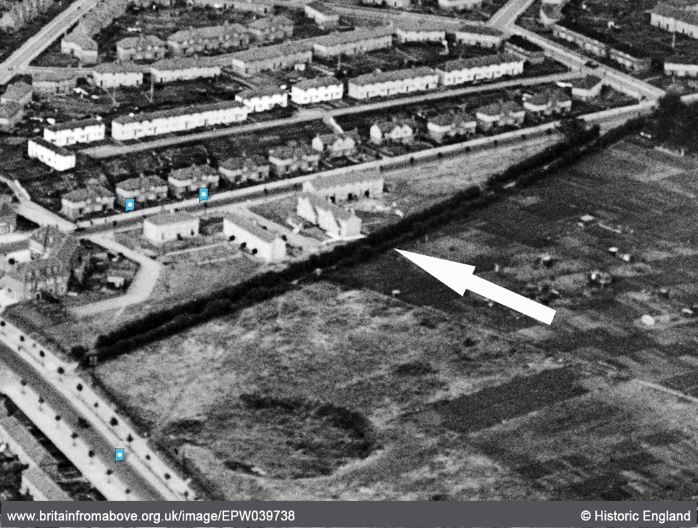
Why this particular little country lane with no buildings along it had intrigued me so much is anyone’s guess, but when I started searching for any references to it I wasn’t really expecting to find anything. To my delight I kept finding the road mentioned in newspaper articles from the early 1900’s, which only helped to feed my curiosities further. The lane was not completely forgotten by the passing of time either and two later-added roads, part of the “Mill Hill” extension to Mile Cross estate; Half Mile Road and Half Mile Close were named after it, even though they don’t mirror it. On top of this, although the old Half Mile Lane no longer exists in name, many of us have regularly and unwittingly travelled the northernmost half of it as we walk or drive along the later-added Mile Cross Road.

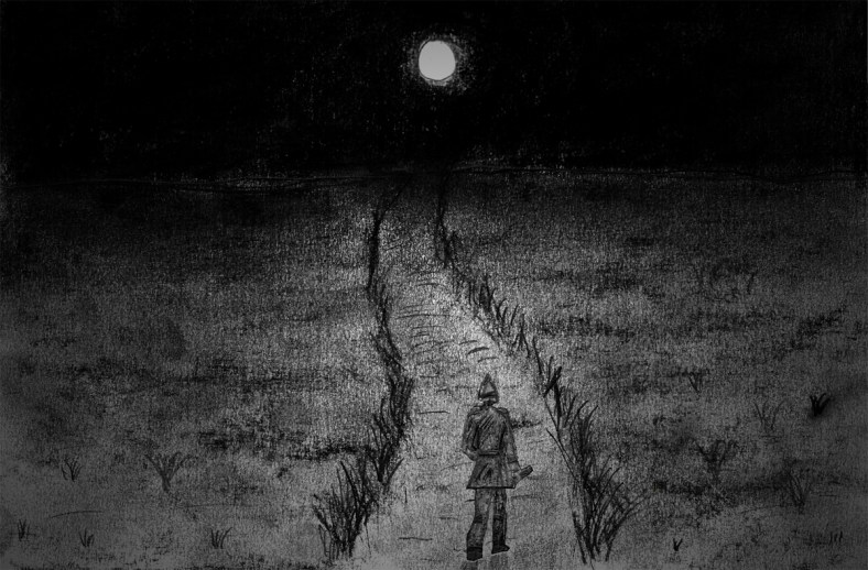
Continue reading “PC Allcock takes a beating”

An old farmer’s lane gets me wondering.

I wrote a piece some time ago now about the names of the roads here on the old estate and the possible/probable thinking behind them, and there’s one road in particular that stands out for me above the rest. It stands out not because it’s named to echo the memory of a famous person who once frequented the streets of Norwich eons ago, or out of some sort of pride-fuelled 1920’s civic duty. This particular road name is purely a nod to what was here, in this exact spot long before the estate and its rows of lovely new houses appeared on the scene. This is a lane where the path has been well-trodden by footsteps for centuries. This particular road formed part of a much-longer road than it does now and occupies the southern-most stretch of the only road that cut from north to south across what we now call Mile Cross. Other than the two main trunk roads (Aylsham and Drayton) that now border the estate as they head in and out of old Norwich, it’s probably the oldest road on the entire estate. The road I’m talking about is a short little road, now closed off at one end, just next to the entrance the nineties Lidl Supermarket on Drayton Road, and it’s named “Old Farm Lane”.

Old Farm Lane, seen from the bottom. Looking North.
Continue reading “An old farmer’s lane gets me wondering.”

There be Pirates!

Tucked away in a quiet little corner of Sloughbottom park is a faint little oval in the grass. When the sun shines and the rain falls, it can be easily overlooked in between the irregular Council grass trims. I remember it looking a lot fresher as a kid in the 80’s, the 80 yard Harco-surfaced track was fresh and it was still occasionally being used.

I remember the park-keeper at the time, a friendly old boy named Phil (Pilbrow?) who my friends and I would often chat to, and he would occasionally bore us with tales of how back in the day he was a bit of a demon on the cycle speedway. If only I knew then (a scruffy-looking little scamp on BMX) that in the future I’d be sitting at a PC blogging about him, I’d have probably paid a bit more interest in what he was trying tell us. When he’d finally get bored of our glazed-over and disinterested faces he’d disappear back into the Pavilion to get back on with his work. This would be the cue for this cheeky little collection of scamps to pick up his funny little green 3-wheeled Council van (remember those?) and relocate it somewhere impossible for him to drive it out of, before cycling away as fast as we could. In hindsight, had he wanted to chase us down we’d chosen the wrong man to tempt fate with on a bicycle!

mxtrack Continue reading “There be Pirates!”

The King, the Queen and the Church.

After the initial phase of house building on the estate was complete attentions were turned towards providing more amenities for the inhabitants of Mile Cross. It was the 1930’s and a third pub and a Church were to be built in close proximity to each other at the northern end of Mile Cross Road.

St Catherine’s Church went up first, it’s foundation Stone was laid by Queen Mary on the 2nd February 1935 and it had opened it’s doors by November the next year. It stands proudly looming over the crossroads of the Mile Cross, Aylsham and Woodcock roads replacing the earlier, Victorian-built St Katherine’s Mission Room of the 1880’s. It is a huge and imposing church when you get up close and personal with it, built primarily out of brick-faced concrete that seems to change colour depending on the light. It was funded somewhat ironically by the Wills Cigarette Family. I’m not a religious man by any means but I do love a nice bit of architecture and this building is rich in it; both inside and out, especially with its Art-Deco inspired interior. Next time you’re passing, pop in and have a look, you might be surprised at how attractive it is. I found the staff (is that the right word?) most welcoming too.

MXqueen Continue reading “The King, the Queen and the Church.”