I’ve talked briefly about the Galley Hills pub previously in my Pubs, Pubs, Pubs entry but this time I’m going to write a piece solely dedicated to this beautiful old pub, mainly because I grew up in the shadow of it, partly because my mother worked there for a while and also because I just love the look of the old place.
Tag Drayton Road
Bloody vandals
Just a short entry tonight after I spotted something of interest as I was dropping off some donations to the Hallswood Animal sanctuary Charity Shop on Drayton Road. On the wall opposite the entrance and next to one of the residential doors is a concentration of ‘graffiti’. On closer inspection some of the inscriptions are quite old. Admittedly they’re not going to get any of the medieval graffiti experts too excited but the shops were only built in 1929.
After a quick zoom in on Photoshop this small section of wall revealed quite a few initials and dates: Continue reading “Bloody vandals”
Drayton Road
I recently stumbled across three fascinating images taken along the section of Drayton Road stretching from the Lidl roundabout to the junction at Asda. I’ve covered Drayton road fairly comprehensively over the course of this blog and those stories can be found below (all worth a read if you haven’t already):
So in this short entry I’m just going to share the images in question and go into a little bit of detail about what we’re looking at one by one.
I’ll start off with this fascinating image kindly provided by Don Thorpe: Continue reading “Drayton Road”
Chalk and Putty
Our beloved Mile Cross is sat on a bedrock of chalk, and on top of this chalk sits the deposits of gravels and clay left behind when the Ice sheets receded during the last Ice age. For millennia after the Ice sheets retreated northwards from where they came, the Wensum has been hard at work, slowly stripping back those layers as it snakes its way back and forth across the landscape, digging out what is now the Wensum Valley and helping to define the topography of the Estate we are familiar with now.
As it does so it exposes the chalk bedrock making it easier for the many generations of humans to excavate: Continue reading “Chalk and Putty”
Nigel Neale
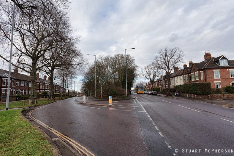
I must admit that I’ve talked quite a lot about Drayton Road in this blog, mainly because it has a lot of stories to tell and partly because I’ve lived on (or just off) it for all bar seven years of my life. This is the main artery for traffic in and out of the City from the North-West and effectively chops about a third of the estate off along the southern portion. Located in the Island part of the estate from the estate’s creation and up until about ten years ago sat the majority of the estate’s schools (Dowson First and Mile Cross Middle), so getting the kids across Drayton road safely required a lot of work from the two sets of dedicated Lollipop ladies.
The first set operated at the crossroads of the Drayton, Bignold and Parr Roads and the second set a few hundred meters down the road at the (long-since closed) junction of Drayton and Wheeler Road. In the early to mid 1980’s, both sets of ladies witnessed their fair share of drama and tragedy.
Two incidents stand out amongst the madness that was – and still is – getting across Drayton Road as a child and I’ll start with the later incident first:
In the mid-1980’s a driver claiming to be unsighted by the low morning sun as he came up Drayton Road from North West ploughed straight through a crowd of Mile Cross Middle and Dowson School children being shepherded across the road by the crossing lady. How nobody was killed is beyond me; one boy ended up near the bus stop, the boy walking just in front of me was thrown 20 feet into the air…. blood, chunks of hair, scattered books and Panini stickers littered the scene.
The result was this pelican crossing, installed slightly east of the junction: Continue reading “Nigel Neale”
Shoes to shoe boxes
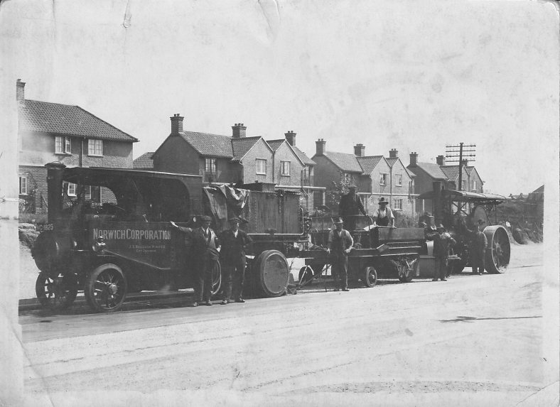
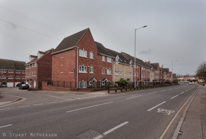
This cramped development of shoe box-sized houses was built on the former site of the Edwards and Holmes shoe factory. The factory was finally demolished in around 2002 and had stood there since it had been completely rebuilt in 1946 Continue reading “Shoes to shoe boxes”
Mile Cross – topography to the point
Before I start, here’s a little warning to let you know that you’re going to see the word “point” a lot. Sorry.
At the very south-western extreme of the estate, the two major boundary routes, the Fakenham and Aylsham Roads meet at a single point. It’s at this point (I did warn you) that you can get a real feel for the topography of the estate. Aylsham Road heads uphill slightly all the way up to the Boundary, and the Fakenham road drops away sharply as it heads off down into the bottom of the Wensum Valley before slowly creeping back up towards Hellesdon. Even out here, Norfolk is far from flat.