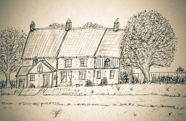
Charlie George – The Brickie who built his own Mile Cross Home.

As a young child who grew up on the estate during the 1980’s, there were quite a few familiar elderly Mile Cross residents whose friendly faces I’d regularly see as we made our way about. Quite a few of those gentle faces are etched into my memory, and now, when I’m wandering around the estate as a middle-aged man, on my way to the pub with my dad, popping to the shops, or simply out for a walk, usually wondering where all that time has gone, I’ll pass a particular house or spot and a memory will suddenly be triggered.

I love these little moments. They’re always unexpected and normally always a pleasure, and for a brief moment I’ll be dragged back to those hazy, rose-tinted days of innocent youth. Every now and then I’ll find myself wondering about those faces from the past and what there stories were.

What I hadn’t thought too much about as a child, when encountering these people, was that many of those elderly residents had most likely lived here since these homes were built in the 1920’s. They had probably seen a lot during their lives, growing up in a very different Norwich to the one I’d grown up in, and they must have watched Mile Cross, and the wider world, change around them.

One thing I’ve noticed over the years of researching the estate is that, until relatively recently, people around here didn’t move about very much. Families often stayed in the same home for decades, sometimes for many generations, which meant that many of these elderly residents had been here from the very beginning.

I have very vague memories of an elderly man tending to his front garden as we made our way noisily past on our way to school. I don’t remember much about him, but I do remember his face and the cheeky smile he’d give us as we made our past.

I later found out during the research phase of the ‘Mile Cross 100’ project that this particular friendly-faced old gentleman was Charlie George.

As a young man, Charlie was one of the hundreds of men employed after the First World War to build the new homes here on the Mile Cross Estate. He was as a bricklayer, who I think, rather wonderfully, eventually ended up living in one of the houses he helped to set out. A house that he would spend living in, not for a few years, but for the rest of his long and eventful life.

Charlie was born in 1904, while his parents lived in in an old cottage out at old Bowthorpe. Back then this area was the remnants of a lost medieval village surrounded by fields, rather than the 1970’s and 1980’s housing estate we know it as today.

The growing George family then moved a bit closer to the city and into one of the last of the Victorian-style terraced houses that are so prevalent throughout Heigham and Lower Hellesdon, however these last few old-style terraces were built in the early 1900’s, the very last of the old style of narrow terraces. The new George family home was located at the bottom end of Nelson Street, close to Heigham Street and Dial House and it was here that Charlie grew up.

He would eventually follow in the footsteps of his father, William George , who was also a skilled bricklayer, and had helped to build some impressive structures here in Norwich. Among other things, William had worked on the city’s Victorian sewer system and the impressively long wall that runs along Waterworks Road, which can still be admired today.

William had rather more stories to tell than your average bricklayer, too.

Continue reading “Charlie George – The Brickie who built his own Mile Cross Home.” →
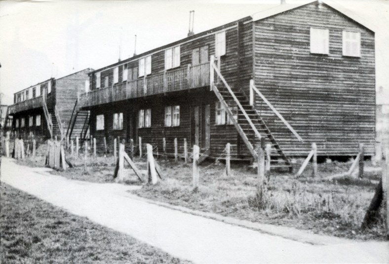
Mile Cross Pioneers and The ‘Wooden Slums’

During the research phase of the recent Mile Cross 100 project one of the little details we were hoping to find out was who were the first people to move into a Mile Cross home on the new estate, however, I wasn’t surprised to learn that we couldn’t figure out exactly who those very first tenants were. I mean, we had some names of people who were here in the beginning, but it was nigh-on impossible to pin down any one person or family that were given the very first set of keys here in Mile Cross, which was a bit of a shame. We knew that people started moving in to some of the first purpose-built Council-owned homes in around 1923, at around the same time, or not long after the new bridge at Mile Cross was opened in September of the same year. By using the Kelly’s Directories (Heritage Centre, top floor, Forum) of the time I did manage to build a fairly accurate map of which streets were inhabited, and in which years. For example, at the start of 1924 there were people already living at Bolingbroke Road, Chambers Road, Civic Gardens, Losinga Crescent, Marshall Road and Rye Avenue, but not all of those roads were yet fully inhabited, or indeed completed at this point. People were effectively moving into a building site, and this theme continued on for about seven years.

Continue reading “Mile Cross Pioneers and The ‘Wooden Slums’” →

Curiosity leads to unexpected stories from my little corner of the Drayton Estate.

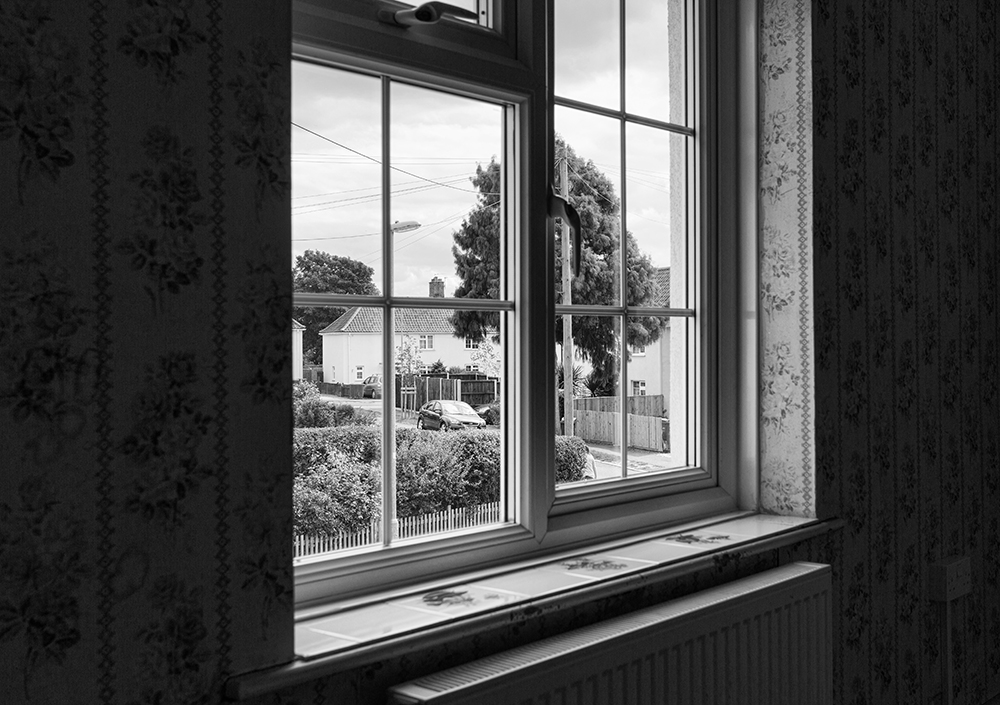
A quiet corner of the Drayton Estate as seen from the once-empty 3 Pinder Close

A while back I wrote a piece about a house just around the corner from mine that had stood empty for a few years (click to read). This house had barely been modernised over the years, and the more I delved into the history of this one particular house, the more interesting it became. Often is the case when researching your local history, following your nose often leads you down historical alleyways that you never expected to end up in, and more often than not, they end up being more fascinating than you ever could have imagined. And it’s this kind of follow-your-nose research that the MX100 research leads, myself included, had been teaching our fellow citizen researchers as we encouraged them to dig for interesting snippets of the estate’s history for the recent Mile Cross 100 project. Another part of this process was also asking for the public to provide us with their own stories about Mile Cross.

Continue reading “Curiosity leads to unexpected stories from my little corner of the Drayton Estate.” →

Mile Cross Photo Walks

Just a short (but picture-heavy) piece this time, and it’s about a project I’ve been involved with for the best part of a year; the Pit Stop Mile Cross Photo walks, in conjunction with a Norfolk-based charity focusing exclusively on the health and wellbeing of men, named MensCraft. Men were invited to join me as ‘The Mile Cross Man’ (or just plain-old Stu) on bi-weekly photo walks within the Mile Cross Estate, starting at Civic Gardens. No photographic experience or fancy photographic equipment were necessary, and my tagline was: “We’ll go for a wander about the estate with our cameras to find some interesting new angles. I might even bore you with some history along the way”.

The rarely-photographed Mile Cross Man with camera in hand on a bright (but chilly) Sunday morning. By Colin Howey.
Continue reading “Mile Cross Photo Walks” →

Cheaper than a revolution

So, it’s been 100 years since those first residents began moving into their new Mile Cross Homes and here in 2023’s take on Mile Cross, we’ve been celebrating the estate’s centenary in many ways. First up was the free theatre/show by the wonderfully on-point theatre company, The Common Lot; named “The Great Estate, 100 Years of Mile Cross”, then there’s the website, (that we still need your help with), The Humap 100 years of Mile Cross (take me there!). There’s also an up-and-coming publication that I’ll be involved with, all about 100 years of Mile Cross called “The Mile Cross Miscellany”, along with the reawakening of the Mile Cross Festival, and a Mile Cross House Lantern Parade, coming in September.

Continue reading “Cheaper than a revolution” →

Mile Cross Photographic Walks and Mile Cross Story Finders.

This is just a short entry to let you all know that I am still here. I realise that it’s been quite a while since I’ve written anything (for this website at least) but that doesn’t mean I’m no longer involved or engaged. Over the last few months I’ve been spread quite thin with various Mile Cross related projects; I’ve written a piece about the trees here in Mile Cross for the Norfolk Gardens Trust Magazine (downloadable here soon), I’ve been writing pieces for the new Mile Cross Newsletter, “mileXchange”, which hopefully you read after it dropped through your letterbox recently (if you live in Mile Cross, that is), the second issue should follow shortly. I’ve also been helping to come up with ideas on how to use the soon-to-open community space named the “mileXchange” in the former Draytona Bakery shop on Drayton Road. On top of all that, I’ve also spent a considerable amount of my spare time as one of the lead researchers for the “Mile Cross 100” project which in 2023 will celebrate the Mile Cross estate turning one hundred years of age.

MX100 logo.

We aim to celebrate a Centenary of Mile Cross by creating a play, a pageant, a website and a book about Mile Cross, so there will be lots to look forward to in the next few months, some of which we’re hoping residents or former residents of Mile Cross can get involved with.

Continue reading “Mile Cross Photographic Walks and Mile Cross Story Finders.” →

PC Allcock takes a beating

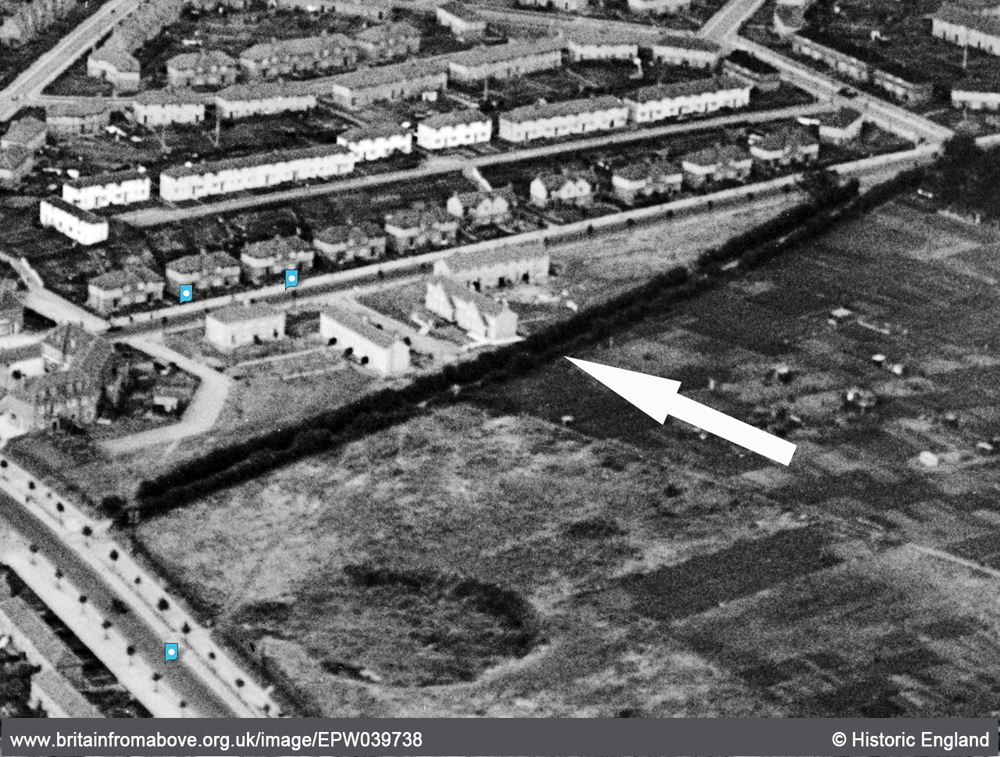
For a couple of my previous pieces ( Old Farm Lane and Sweetbriar Marsh ) I’d been studiously looking into the countryside landscape and the scattering of buildings that were here in what we now call Mile Cross, long before the later housing estate turned up. Whilst poring over the old maps and aerial photographs, searching the landscape for anything of interest, my eyes kept falling upon a little lane that was lost long ago. This little lane was called “Half Mile Lane” and it ran south from Upper Hellesdon Road (now Aylsham Road) down to Lower Hellesdon Road (now Drayton Road), seeming only exist to enable the local farmers to access the many fields that made up our landscape and to connect the two main roads together. Unlike the bloated and expanding city we live in today, Norwich had barely stretched out this far along Lower Hellesdon Road, the only buildings of any merit being the ancient Lower Hellesdon Farm and the pair of old Red Cottages about half a mile further out at the slough bottom. However, at the northern end of Half Mile Lane where it met Upper Hellesdon (Aylsham) Road, The city had been a little more adventurous, managing to branch its way out along the busy, Aylsham/Cromer Road as far as the boundary. Along this busier trunk road, which led out to Aylsham and the then the coast, the maps show that there were plenty of homes and businesses dotted along it all the way from the inner boundary at the old city walls, right the way up to the outer boundary of the city and county at the imaginatively named boundary at St Faith’s Cross, or the area known then as Mile Cross.

The lower half of Half Mile Lane running from Mile Cross Road (top right) to Drayton Road (bottom left), now lost under the gardens of the later added homes of Shorncliffe Avenue. In this image the fields have been replaced by houses to the west and allotments to the east, and the northern half of the lane has been repurposed as Mile Cross Road.

Why this particular little country lane with no buildings along it had intrigued me so much is anyone’s guess, but when I started searching for any references to it I wasn’t really expecting to find anything. To my delight I kept finding the road mentioned in newspaper articles from the early 1900’s, which only helped to feed my curiosities further. The lane was not completely forgotten by the passing of time either and two later-added roads, part of the “Mill Hill” extension to Mile Cross estate; Half Mile Road and Half Mile Close were named after it, even though they don’t mirror it. On top of this, although the old Half Mile Lane no longer exists in name, many of us have regularly and unwittingly travelled the northernmost half of it as we walk or drive along the later-added Mile Cross Road.

Continue reading “PC Allcock takes a beating” →

History underfoot and hints of what was here before.

The wandering wonderer. I’m often wandering about Norwich with my camera in hand and my head in two separate places, usually the same space but in two completely different time-zones. No, not like you used to see in those 1980’s movies where some Fleet-Street shyster dressed in a suite that needed a volume control, who has three or four clocks on the wall behind him showing New York, London and Japan whilst he arrogantly barks down a mobile phone the size of a breeze-block. My head can be found wandering and wondering through and across completely different sets of decades, or floating between completely different centuries.

Continue reading “History underfoot and hints of what was here before.” →

Lassie almost made it home.

This is a story that I have already written about in the past, over two separate pieces and I thought it was about time to merge the two old posts together to tell the whole story in one. It’s a story that demands attention and it makes far more sense to be able to read it all in one sitting.

In the very northern corner of the estate and just behind the Boundary Pub is a quiet little cul-de-sac named Spynke Road. Like a lot of the roads up there on the very fringes of the boundary it wasn’t always this quiet. Most of the roads adjoining Boundary Road were once connected directly to it, allowing for people to use it as a rat-run to avoid the increasing volumes of traffic building up on the increasingly-busy outer ring road. Soon these roads were deemed too unsafe for the local residents and it was decided that for everybody’s safety it would make sense to have them closed off. Because of these road closures the area now has a strangely quiet and closed-off feel, but with the unrelenting background drone of traffic. As annoying as that background droning may be to the visitors or new residents, the modern day residents of Spynke Road are probably more than happy for that to be the only drone they need to worry about, as will become apparent later on.

Continue reading “Lassie almost made it home.” →

An old farmer’s lane gets me wondering.

I wrote a piece some time ago now about the names of the roads here on the old estate and the possible/probable thinking behind them, and there’s one road in particular that stands out for me above the rest. It stands out not because it’s named to echo the memory of a famous person who once frequented the streets of Norwich eons ago, or out of some sort of pride-fuelled 1920’s civic duty. This particular road name is purely a nod to what was here, in this exact spot long before the estate and its rows of lovely new houses appeared on the scene. This is a lane where the path has been well-trodden by footsteps for centuries. This particular road formed part of a much-longer road than it does now and occupies the southern-most stretch of the only road that cut from north to south across what we now call Mile Cross. Other than the two main trunk roads (Aylsham and Drayton) that now border the estate as they head in and out of old Norwich, it’s probably the oldest road on the entire estate. The road I’m talking about is a short little road, now closed off at one end, just next to the entrance the nineties Lidl Supermarket on Drayton Road, and it’s named “Old Farm Lane”.

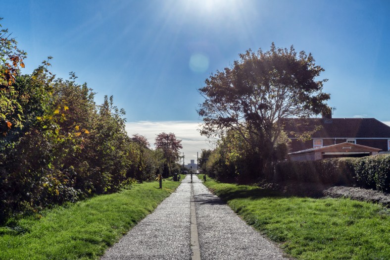
Old Farm Lane, seen from the bottom. Looking North.
Continue reading “An old farmer’s lane gets me wondering.” →